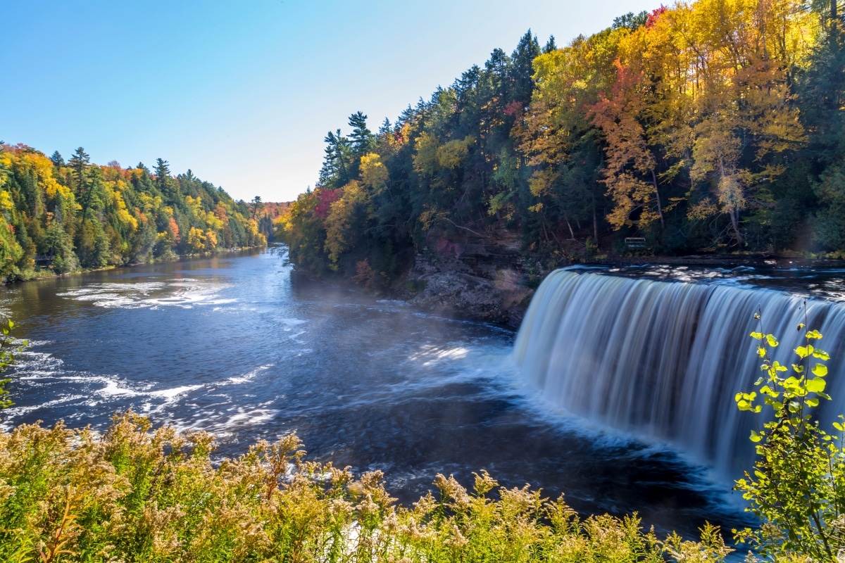
The Root Beer Falls — One of the largest waterfalls east of the Mississippi, spanning 200 feet wide with a 50-foot drop. The amber-colored water comes from tannins in the surrounding cedar swamps, creating Michigan’s most photogenic natural wonder.
Deep in Michigan’s Upper Peninsula, the Tahquamenon River gathers strength from the surrounding wilderness before plunging over a 200-foot-wide ledge in a thunderous cascade. This is Upper Tahquamenon Falls—the second-largest waterfall east of the Mississippi (after Niagara)—and seeing it for the first time is genuinely jaw-dropping. The water runs amber-gold from the cedar tannins upstream, earning it the nickname “Root Beer Falls.”
But Tahquamenon offers more than one spectacular waterfall. Four miles downstream, the Lower Falls splits around an island accessible by rowboat, creating five smaller cascades you can explore from multiple angles. The 46,000-acre park protects nearly 40 miles of the Tahquamenon River corridor, with 25 miles of trails, modern campgrounds, and some of the best fall color in the Midwest. Whether you come for the waterfalls, the wilderness, or the wildlife, Tahquamenon delivers a world-class experience that rivals any national park.
Quick Facts
- 📍 Location: Luce County, Michigan (Upper Peninsula)
- 📐 Size: 46,000 acres (largest state park in Michigan)
- 🌊 Upper Falls: 200 feet wide × 50 feet tall
- 💧 Flow Rate: 50,000 gallons per second (peak)
- 🚗 From Mackinac: 1.5 hours via I-75 N
- 🎫 Admission: $9 Recreation Passport or $17 day pass
Best Season to Visit
Tahquamenon is spectacular year-round, but each season offers a different experience. Fall color (late September to mid-October) draws the biggest crowds for good reason—the amber water against red and gold maples is unforgettable. Winter transforms the falls into a frozen wonderland, while summer offers warm swimming in the tea-colored pools below the Lower Falls.
| Season | Weather | Crowds | Best For |
|---|---|---|---|
| 🍂 Fall (Sep-Oct) | 40-60°F, crisp | Very High | Peak foliage, photography, hiking |
| ☀️ Summer (Jun-Aug) | 70-80°F, pleasant | High | Swimming, camping, boating |
| 🌸 Spring (Apr-May) | 40-60°F, rain | Low | Peak water flow, fewer crowds |
| ❄️ Winter (Nov-Mar) | 10-30°F, snow | Low | Frozen falls, snowshoeing, solitude |
Entrance Fees & Passes
| Fee Type | Cost | Notes |
|---|---|---|
| Recreation Passport (Annual) | $9 resident / $35 non-resident | Add to vehicle registration |
| Day Pass | $17 | At park entrance |
| Rowboat Rental | $5 per person | Lower Falls island access |
Upper Tahquamenon Falls
The Upper Falls is the main attraction—and for good reason. At 200 feet across and 50 feet tall, it’s the second-largest waterfall east of the Mississippi, surpassed only by Niagara. But unlike Niagara, there’s no city, no casinos, no crowd barriers. Just you, the roar of the water, and the primal power of nature.
The viewing area is reached via a paved 0.4-mile trail from the Upper Falls parking area. For the best views, descend the 94-step staircase to the lower viewing platform, where you can feel the mist on your face. The amber color comes from tannins leaching from cedar, spruce, and hemlock in the upstream swamps—completely natural and safe.
Lower Tahquamenon Falls
Four miles downstream, the Lower Falls offers a completely different experience. Here, the river splits around a small island, creating five separate cascades. You can rent a rowboat ($5/person) to reach the island, where trails let you explore each waterfall from different angles.
The Lower Falls area also has the best swimming in the park. The pools below the cascades are chest-deep in some spots, with the characteristic root-beer-colored water that’s perfectly safe and surprisingly refreshing. On summer weekends, families spread out on the rocks for picnics and swimming.
Top Trails
| Trail | Distance | Difficulty | Highlights |
|---|---|---|---|
| 🥾 Upper Falls Trail | 0.8 mi roundtrip | Easy | Main waterfall, viewing platforms |
| 🥾 Lower Falls Trail | 0.9 mi loop | Easy | 5 cascades, rowboat to island |
| 🥾 North Country Trail | 4.5 mi segment | Moderate | Connects Upper/Lower Falls |
| 🥾 Wilderness Loop | 7.5 mi | Moderate | Backcountry, wildlife, solitude |
| 🥾 Giant Pines Loop | 1.0 mi | Easy | Old-growth white pines |
📍 Download the official trail map (PDF) from Michigan DNR.
Best Photo Spots
Tahquamenon Falls is one of the most photographed locations in Michigan. The amber-colored water creates unique images year-round. Here are the must-visit spots for photographers:
| 📷 Location | Best For | Best Time | Tips |
|---|---|---|---|
| Upper Falls Lower Platform | Classic waterfall shots | Sunrise, fog conditions | 94 steps down, bring tripod |
| Upper Falls Overlook | Wide panoramas | Afternoon light | Accessible, less mist |
| Lower Falls Island | Multi-angle cascades | Golden hour | Rowboat required ($5) |
| North Country Trail Bridge | River reflections | Fall foliage peak | Early morning, no crowds |
| Rivermouth | Lake Superior sunsets | Evening | Combine with beach walk |
Photography Pro Tips:
- 🍂 Fall Color Peak: Late September to mid-October
- 🌅 Best Light: Sunrise for misty shots, sunset for warm tones
- 💧 Shutter Speed: Use 1/4 to 2 seconds for silky water effect
- 🦟 Summer Warning: Blackflies are brutal May-July, bring head net
Camping & Cabins
Tahquamenon has two developed campgrounds plus backcountry sites. The modern campgrounds offer electric hookups, modern restrooms, and easy access to the falls. For a more rustic experience, the park also has rental cabins near the Lower Falls.
| Area | Sites | Price/Night | Amenities |
|---|---|---|---|
| 🏕️ Rivermouth Unit | 175 | $30-$40 | Electric, modern restrooms, near Lake Superior |
| 🏕️ Lower Falls Unit | 36 | $23-$30 | Rustic, vault toilets, near falls |
| 🏠 Rental Cabins | 6 | $75-$110 | Sleeps 4-6, heat, electricity |
Reserve at Michigan DNR Reservations. Fall weekends book 6+ months in advance!
Trip Budget Calculator
| Expense | Budget | Mid-Range | Comfort |
|---|---|---|---|
| Lodging (2 nights) | $60 (camping) | $80 (electric site) | $200 (cabin) |
| Park Entry | $9 (passport) | $9 | $9 |
| Rowboat Rental | $0 | $20 (4 people) | $20 |
| Food (2 days) | $50 | $100 | $150 |
| Gas (from Mackinac) | $30 | $30 | $30 |
| Total | $149 | $239 | $409 |
Wildlife & Nature
The 46,000-acre park protects one of the largest wilderness areas in Michigan. Black bears are common but rarely seen. Moose sightings have increased in recent years—scan the wetlands at dawn. The river itself supports brook trout, steelhead, and salmon runs.
| Season | Wildlife | Best Locations |
|---|---|---|
| 🌸 Spring | Black bears (emerging), migrating warblers | Wilderness Loop, river corridor |
| ☀️ Summer | Bald eagles, great blue herons, beavers | Lower Falls, Rivermouth |
| 🍂 Fall | Salmon runs, deer, moose (rare) | River mouth, wetlands at dawn |
| ❄️ Winter | Wolves (tracks), pine martens, owls | Backcountry trails |
Safety Information
| Hazard | Risk Level | Prevention |
|---|---|---|
| 🌊 Swift Water | High | Never swim above the falls, stay in designated areas |
| 🐻 Black Bears | Low-Moderate | Store food properly, use bear boxes at campgrounds |
| 🥶 Hypothermia | Moderate (spring/fall) | Water is cold year-round, bring dry clothes |
| 🦟 Mosquitoes/Blackflies | High (May-Jul) | Bring strong repellent, head nets |
Getting There
Address: 41382 W M-123, Paradise, MI 49768
- From Mackinac Bridge: 1.5 hours via I-75 N to M-123
- From Marquette: 2.5 hours via M-28 E
- From Detroit: 5.5 hours via I-75 N
GPS Coordinates: 46.5825° N, 85.2483° W
Nearby Attractions
- Pictured Rocks National Lakeshore (1.5 hours) — Colorful sandstone cliffs on Lake Superior
- Whitefish Point (30 min) — Shipwreck museum, Great Lakes birding
- Paradise, MI (15 min) — Small town with restaurants, supplies
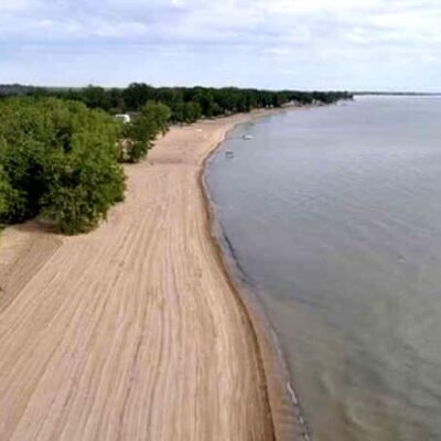
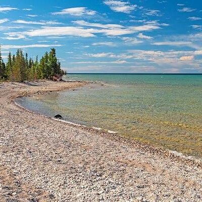
- Lake Superior Shoreline (30 min) — Beaches, agates, stunning views
Frequently Asked Questions
Why is the water brown/amber colored?
The distinctive root-beer color comes from tannins that leach from the cedar, spruce, and hemlock trees in the upstream swamps. It’s completely natural, harmless, and actually makes for stunning photos!
Can you swim at Tahquamenon Falls?
Yes! The Lower Falls area has designated swimming spots where you can wade and swim in the amber-colored pools. Never swim above the falls or in swift current areas.
Is Tahquamenon Falls bigger than Niagara?
Niagara is taller and has more water volume, but Tahquamenon is the second-largest waterfall east of the Mississippi by volume. It’s wider than many people expect—200 feet across!
Are there bugs?
Yes, especially May through July. Mosquitoes and blackflies can be intense. Bring strong repellent (DEET or Picaridin) and consider a head net for trail hiking.
Are dogs allowed at Tahquamenon Falls State Park?
Yes! Dogs are welcome on all 40+ miles of hiking trails, in campgrounds, and even on the rowboats to the Lower Falls island. Requirements:
- ✅ Must be on a 6-foot leash at all times
- ✅ Allowed on trails, campgrounds, and rowboats
- ❌ Not allowed in buildings (visitor center, restrooms, brewery)
- ❌ Not allowed on the designated swimming beach at Rivermouth
Pro tip: The Lower Falls is the best area for dogs—they can explore the island trails with you!
Where exactly can you swim?
Swimming is allowed in designated areas at the Lower Falls, where pools below the cascades are chest-deep and refreshing. The amber “root beer” water is safe and surprisingly warm in summer. Never swim above the falls or in swift current. The Rivermouth campground also has a Lake Superior beach (no dogs allowed there).
What is a Michigan Recreation Passport?
The Recreation Passport ($17 for residents, $34 for non-residents) is required for vehicle entry to all Michigan state parks and recreation areas. It can be purchased when registering your vehicle or at park entrances.
What are the best state parks in Michigan's Upper Peninsula?
Top UP parks include Pictured Rocks (stunning cliffs), Tahquamenon Falls (second-largest waterfall east of Mississippi), Porcupine Mountains (wilderness hiking), and Copper Harbor area parks for remote beauty.
Can I camp on the beach in Michigan?
Several Michigan state parks offer beachfront or near-beach camping on the Great Lakes, including Ludington, Holland, and Sleeping Bear Dunes area campgrounds. Lakefront sites are extremely popular and sell out quickly.
When is the best time to visit Michigan state parks?
Summer (June through August) is peak season for beaches and camping. Fall brings spectacular foliage, especially along the Lake Michigan shoreline. Winter offers cross-country skiing and ice fishing at many parks.
Plan Your Visit
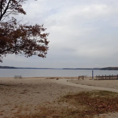
More parks nearby: Muskallonge Lake State Park is within about an hour’s drive, while Brimley State Park lies within about an hour’s drive.
Experience Michigan’s Mightiest Waterfall
From the thundering 200-foot cascade of the Upper Falls to the swimmable pools of the Lower Falls, Tahquamenon delivers a wilderness experience that rivals any national park. Plan your visit to Michigan’s Upper Peninsula today.
Explore More Michigan State Parks
Tahquamenon Falls State Park is one of many outstanding state parks in Michigan. Discover more parks in our Best State Parks in Michigan guide, or use our Park Finder to search by activity, location, or features.

Park Location
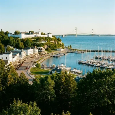

Top Tours & Activities Near Mackinaw City
 from $128
 from $12
 from $95