🌤 Weather at Ainsworth State Park by season
| Spring | Summer | Fall | Winter |
|---|---|---|---|
| 38–66 °F | 52–80 °F | 40–74 °F | 34–47 °F |
Each range runs from the coldest monthly average low to the warmest monthly average high in that season (1991-2020 climate normals), measured at Bonneville Dam, 6 mi away, elevation 62 ft. Conditions at the park can differ from the station, especially where elevation differs — check a forecast before you go.

🌊 The #1 Base Camp for Oregon’s Waterfall Corridor — 40 Full-Hookup Sites, 4 Miles From Multnomah Falls, Direct Trail Access to Horsetail & Ponytail Falls — A full-service Oregon state park campground in the heart of the Columbia River Gorge National Scenic Area with 40 full-hookup RV sites, walk-in tent sites, hiker/biker camp, hot showers, direct access to the Gorge Trail #400 and Horsetail Falls Trail #438, and proximity to 10+ major waterfalls — 35 miles east of Portland, Multnomah County, Oregon
Why Ainsworth Is the Best Campground Near Multnomah Falls
If you’re planning a trip to Oregon’s Columbia River Gorge, the single most important decision you’ll make is where to set up camp. Ainsworth State Park answers that question definitively — it’s the only full-hookup campground inside the Waterfall Corridor, sitting at the eastern end of the Historic Columbia River Highway with direct trail access to some of the most spectacular waterfalls in North America.
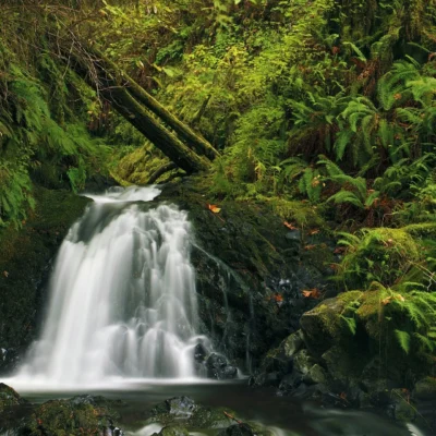
Multnomah Falls (620 feet, Oregon’s tallest) is just 4 miles west. Horsetail Falls is literally at the park boundary. Ponytail Falls — where you walk behind a waterfall — is a 20-minute hike from your campsite. And that’s just the beginning of a corridor that includes Wahkeena Falls, Bridal Veil Falls, Latourell Falls, and a dozen more within a 15-minute drive.
At 35 miles east of Portland, Ainsworth is close enough for a quick day trip but far enough into the Gorge to feel like a genuine wilderness escape — ancient Douglas fir, moss-draped big-leaf maple, and the constant sound of falling water.
Campground Details
Ainsworth’s campground is compact but well-designed, tucked into a forested canyon at the base of St. Peter’s Dome — a massive basalt monolith that towers above the Columbia River. The forest canopy provides excellent shade and privacy between sites.
| Site Type | Count | Hookups | Details |
|---|---|---|---|
| Full Hookup RV | 40 sites | Water, electric (50A), sewer | Paved pads, most pull-through |
| Walk-In Tent | 6 sites | None | Short walk from parking, more secluded |
| Hiker/Biker | Shared area | None | No reservation needed, first-come |
| ADA Accessible | 1 site | Full hookup | Accessible restrooms nearby |
Campground Amenities
- Hot showers — clean, well-maintained restroom buildings
- Flush toilets — modern facilities throughout
- RV dump station — on-site (small fee may apply)
- Firewood — available for purchase at the park (buy local to prevent invasive species)
- Playground — for families with young children
- Picnic shelters — day-use area with tables and grills
⚠️ The Noise Factor: What You Need to Know
Let’s address the elephant in the room — Ainsworth sits between I-84 and an active railroad line. You will hear highway traffic and freight trains, especially at night. This is the single most common complaint in campground reviews, and it’s legitimate.
Our honest assessment: The noise is noticeable but manageable for most campers. Earplugs solve the problem for light sleepers, and the walk-in tent sites are slightly more buffered by forest than the RV loop. The trade-off — waking up 4 miles from Multnomah Falls with full hookups — is worth it for the vast majority of visitors.
Pro Tip: If noise is a dealbreaker, consider Viento State Park (near Hood River, quieter but further from waterfalls) or Beacon Rock State Park (Washington side, scenic but different trail access).
Waterfalls Within Reach
This is why you’re here. Ainsworth sits at the epicenter of the densest concentration of major waterfalls in the Pacific Northwest. Here’s every significant waterfall within a 20-minute drive, listed west to east:
| Waterfall | Height | Distance From Camp | Hike Difficulty |
|---|---|---|---|
| Latourell Falls | 249 ft | 12 mi west | Easy (0.3 mi to viewpoint) |
| Bridal Veil Falls | 120 ft | 9 mi west | Easy (0.6 mi round trip) |
| Wahkeena Falls | 242 ft | 6 mi west | Moderate (loop available) |
| Multnomah Falls | 620 ft | 4 mi west | Easy to bridge, moderate to top |
| Oneonta Gorge | — | 2 mi west | Currently CLOSED (safety) |
| Horsetail Falls | 176 ft | Adjacent to park | Easy (roadside viewpoint) |
| Ponytail Falls | 100 ft | 0.4 mi hike | Easy-Moderate (walk behind it!) |
| Triple Falls | 135 ft | 2.2 mi hike | Moderate |
The Must-Do Waterfall Loop
From Ainsworth, the Horsetail Falls → Ponytail Falls → Triple Falls loop is the park’s signature hike. Start at the Horsetail Falls trailhead (literally at the park entrance), take Trail #438 behind Ponytail Falls (an unforgettable experience), and continue to Triple Falls before looping back. Total: ~4.5 miles, 800 feet elevation gain, 2–3 hours.
For the ambitious: Connect to the Wahkeena-Multnomah Falls Loop (5.4 miles) via the Gorge Trail #400 for a full day of waterfall chasing that hits 5+ major falls in a single outing.
Hiking Trails
Beyond the waterfall corridor, Ainsworth provides access to some of the Gorge’s most rewarding — and challenging — trail systems.
| Trail | Distance | Elevation Gain | Difficulty | Highlights |
|---|---|---|---|---|
| Horsetail Falls Trail #438 | 2.7 mi RT | 400 ft | Easy-Moderate | Behind Ponytail Falls |
| Triple Falls Extension | 4.5 mi loop | 800 ft | Moderate | Three-tiered waterfall |
| Gorge Trail #400 | Varies | Varies | Easy-Moderate | Connects waterfall corridor |
| Nesmith Point Trail | 9.6 mi RT | 3,800 ft | Strenuous | Highest point in Gorge, St. Peter’s Dome |
| Wahkeena-Multnomah Loop | 5.4 mi | 1,600 ft | Moderate | 5+ waterfalls, Fairy Falls |
| Larch Mountain Trail | 13.8 mi RT | 4,000 ft | Strenuous | Summit views of 5 Cascade peaks |
Eagle Creek Trail Status (2026)
⚠️ Important: The famous Eagle Creek Trail — one of Oregon’s most iconic hikes — is currently closed due to severe storm damage from December 2025. Massive debris flows, mudslides, and hundreds of fallen trees have made the trail “unrecognizable” according to the US Forest Service. Repairs are expected to take months. Always check current trail conditions at the USFS Mt. Hood National Forest website before planning hikes in the Gorge.
The Columbia River Gorge National Scenic Area
Ainsworth sits within the Columbia River Gorge National Scenic Area — the largest National Scenic Area in the United States, stretching 80 miles along the Columbia River from the Sandy River to the Deschutes River. The Gorge was carved by catastrophic Missoula Floods during the last Ice Age, creating the dramatic basalt cliffs, hanging valleys, and waterfall amphitheaters you see today.
The Historic Columbia River Highway — America’s first planned scenic roadway, completed in 1922 — was engineered specifically to showcase this landscape, with carefully designed bridges, viewpoints, and waterfall pulloffs. Ainsworth sits at the highway’s eastern terminus, where the Waterfall Corridor meets the wider Gorge.
Beyond the Waterfalls: What Else to Do
| Activity | Location | Distance | Notes |
|---|---|---|---|
| Historic Columbia River Highway | Portland → Hood River | Starts at park | America’s first scenic highway |
| Crown Point Vista House | Corbett, OR | 15 mi west | 360° Gorge panorama |
| Bonneville Dam & Fish Hatchery | Cascade Locks | 5 mi east | Underwater fish viewing, free |
| Bridge of the Gods | Cascade Locks | 7 mi east | PCT crossing, $2 toll |
| Beacon Rock | WA side | 12 mi east | 848-foot volcanic plug, trail to summit |
| Hood River | Hood River, OR | 30 mi east | Windsurfing, craft beer, Mt. Hood views |
| Multnomah Falls Lodge | Bridal Veil | 4 mi west | Historic lodge, restaurant, gift shop |
Best Time to Visit
| Season | Weather | Waterfall Flow | Crowds | Best For |
|---|---|---|---|---|
| Spring (Apr–Jun) | 50–68°F | 🌊 PEAK | Moderate | Maximum waterfall volume, wildflowers, lush green |
| Fall (Sep–Oct) | 50–68°F | 💧 Low | Low | Foliage, quiet trails, comfortable camping |
| Summer (Jul–Aug) | 68–85°F | 💧 Low-Med | HIGH | Best weather, longest days, all trails open |
| Winter (Nov–Mar) | 35–48°F | 🌊 High | Very Low | Campground CLOSED, day-use possible |
The insider move: Visit in late April to mid-June for peak waterfall flow and moderate crowds. Summer is the easiest season weather-wise, but Multnomah Falls now requires timed-entry permits during peak months — plan ahead.
💰 Trip Cost Estimator
| Expense | Cost | Notes |
|---|---|---|
| Day Use Parking | Free | Ainsworth is not among the Oregon state parks that charge a day-use parking fee |
| Full Hookup RV Site | $28–$34/night | 40 sites, water/electric 50A/sewer |
| Walk-In Tent Site | $19–$22/night | 6 sites, more secluded |
| Hiker/Biker Camp | $8/night | First-come, no reservation |
| Firewood Bundle | $5–$7 | Buy at park, don’t bring outside wood |
| Multnomah Falls Permit | FREE (timed) | Required summer peak season |
| Sample Trip | Cost | What You Get |
|---|---|---|
| Day Trip (2 adults) | $0 | Park + waterfall corridor + Gorge Trail |
| Weekend Camping (tent, 2 nights) | $38–$44 | Tent site + waterfall access + showers |
| Weekend RV (full hookup, 2 nights) | $56–$68 | Full hookup + all trails + Gorge access |
| Week-Long RV Stay | $196–$238 | Complete Gorge exploration base |
How to Get Here
From Portland: Take I-84 East to Exit 35 (Ainsworth State Park). The drive is approximately 35 miles and takes 30–45 minutes depending on traffic. The park is well-signed from the highway.
From Hood River: Take I-84 West to Exit 35. About 30 miles, 30 minutes.
Historic Columbia River Highway: If you’re driving the scenic route from Portland, the park is at the eastern end of the waterfall corridor — you’ll pass Multnomah Falls, Wahkeena Falls, and Horsetail Falls before arriving.
Reservation Tips
Ainsworth is one of the most popular campgrounds in Oregon — it books out fast. Here’s how to secure a site:
- Book 6 months ahead for summer weekends (June–August)
- Weekday stays are significantly easier to book and quieter
- Shoulder season (April–May, September–October) offers the best combination of availability and weather
- Hiker/Biker sites are first-come, first-served — a great fallback option
- Reserve through Oregon State Parks reservation system (oregonstateparks.reserveamerica.com)
Alternative Gorge Campgrounds
If Ainsworth is booked, these are your best backup options in the Columbia River Gorge:
| Campground | Location | Distance to Multnomah Falls | Best For |
|---|---|---|---|
| Viento State Park | Near Hood River, OR | ~35 mi east | Quieter, windsurfing access |
| Beacon Rock SP | WA side | ~15 mi east | Scenic rock climb, Hamilton Mtn |
| Memaloose SP | Near Mosier, OR | ~40 mi east | River views, less crowded |
| Lost Lake Resort | Mt. Hood NF | ~50 mi south | Mountain lake, Mt. Hood views |
Frequently Asked Questions
How far is Ainsworth from Multnomah Falls?
About 4 miles — a 5-minute drive. You can also reach it via the Gorge Trail #400 on foot, though most visitors drive to the falls parking area (timed-entry permit may be required in summer).
Is the campground really noisy?
Yes, there is highway and train noise. I-84 runs nearby, and freight trains pass through at all hours. Most campers find it manageable — bring earplugs if you’re a light sleeper. The forest setting helps dampen sound, and the walk-in tent sites are the quietest.
Can I walk to a waterfall from camp?
Yes — Horsetail Falls is at the park boundary, and Ponytail Falls (where you walk behind the waterfall) is a 20-minute hike via Trail #438. This is the single best campground-to-waterfall proximity in the Gorge.
When should I book?
6 months ahead for summer weekends. The campground opens mid-March and closes October 31. Spring and fall shoulder seasons offer the best balance of availability, weather, and waterfall flow.
Is Eagle Creek Trail open?
No — as of early 2026, it’s closed due to severe storm damage from December 2025. Check the USFS Mt. Hood National Forest website for current status before planning.
Can I walk behind Ponytail Falls?
Yes! Trail #438 passes directly behind the 100-foot Ponytail Falls — one of the most photographed spots in the Gorge. The trail surface is rocky but manageable. It’s a 0.4-mile hike from the Horsetail Falls trailhead near the park.
Do I need a timed-entry permit for Multnomah Falls?
During peak summer months, yes. Oregon has implemented timed-entry permits for the Multnomah Falls corridor to manage overcrowding. Permits are free but must be reserved in advance. Check the official Oregon State Parks website for current requirements.
Nearby state parks: If you have extra time, John Yeon State Scenic Corridor is a short drive away, and George W. Joseph State Natural Area is a short drive away.
🌊 Oregon’s #1 Waterfall Base Camp
40 full-hookup sites in the heart of the Gorge — 4 miles from Multnomah Falls, direct trail to Ponytail Falls, Gorge Trail #400 access, and 10+ major waterfalls within a 15-minute drive. The only full-hookup campground inside the Waterfall Corridor.
Wildlife & Nature
Ainsworth SP — in the Columbia River Gorge — the only sea-level passage through the Cascade Range. The park’s temperate rainforest, waterfalls, and basalt cliffs support bald eagles, osprey, and Roosevelt elk. Old-growth Douglas fir and western red cedar tower above.
Nearby Attractions
Columbia River Gorge NSA — surrounding. Multnomah Falls — 3 miles west — the tallest waterfall in Oregon (620 ft). Bonneville Dam — 3 miles east.

🐾 Dogs & Pets at Ainsworth State Park
- Pets allowed? statewide rule
- Pets are welcome in Oregon state parks and on most ocean beaches but must be leashed except in designated off-leash areas.
- Leash rule statewide rule
- Leash no longer than 6 feet required in developed park areas
- Beaches & swim areas statewide rule
- Pets are allowed on most ocean beaches under direct control; western snowy plover nesting areas restrict pets March 15 - Sept. 15; leash required on the beach at some parks (e.g. Cape Lookout)
- Cabins & lodging statewide rule
- Designated pet-friendly yurts and cabins at many parks (South Beach has 14 pet-friendly yurts, Tugman 8); maximum two dogs and/or cats; $10 per night pet fee
- Pet fees statewide rule
- $10 per night for pet-friendly yurts/cabins; no pet fee for day use or campsites
- Statewide exceptions statewide rule
- Pets prohibited at Dabney SRA, the Trail of Ten Falls at Silver Falls, and Shore Acres; off-leash areas at Stub Stewart, Willamette Mission, Elijah Bristow, Cottonwood Canyon and LaPine
Are dogs allowed at Ainsworth State Park?
Pets are welcome in Oregon state parks and on most ocean beaches but must be leashed except in designated off-leash areas. Individual parks can post stricter rules — check signage on arrival.
Rules verified July 2026 via stateparks.oregon.gov. More: Oregon state parks guide · Dog rules in all 50 states compared
Park Location
Plan your gear for Ainsworth State Park
From our editorial guides, matched to this park’s activities: