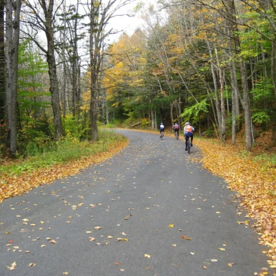
🚴 The Berkshires’ Most Beautiful Rail-Trail — 12.7 Miles Between Mountains, Lakes, and Small Towns — Ashuwillticook Rail Trail in Berkshire County, Massachusetts, 12.7-mile paved rail-trail from Lanesborough to Adams, runs alongside Cheshire Reservoir and Hoosac River, views of Mount Greylock (Massachusetts’ highest peak), former Cheshire Branch of the Boston & Maine Railroad, flat and accessible, biking hiking cross-country skiing — Berkshire County, MA
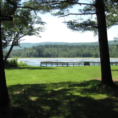
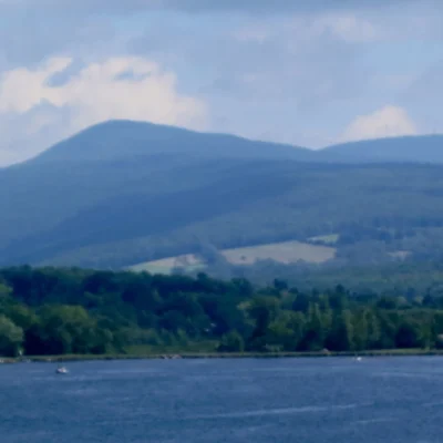
The Berkshires are known for art museums and summer theater. The Ashuwillticook Rail Trail is for the people who’d rather be on a bike. 12.7 miles of paved trail between Lanesborough and Adams, running along the shore of Cheshire Reservoir and the Hoosac River — with Massachusetts’ highest peak, Mount Greylock, rising above it all.
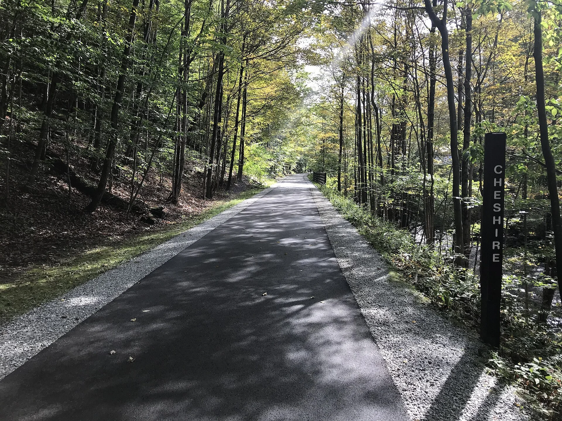
The name is Mohican — “Ashuwillticook” means “the pleasant river between the hills” — and the trail earns it. Flat, paved, and car-free, it follows the old Cheshire Branch of the Boston & Maine Railroad through one of the most scenic corridors in New England.
Trail Details
| Feature | Details |
|---|---|
| Length | 12.7 miles one-way (25.4 miles round trip). Lanesborough to Adams through Cheshire. Flat grade — former railroad |
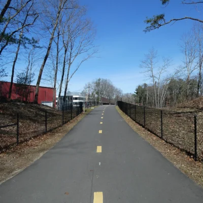
| Surface | Paved asphalt for the entire length. Suitable for road bikes, hybrids, strollers, and wheelchairs |
| Grade | Nearly flat — less than 2% grade throughout. The most accessible trail in the Berkshires |
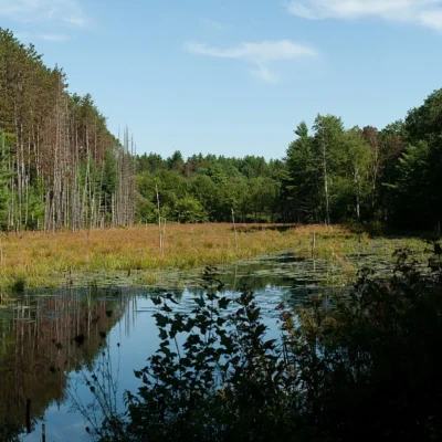
| Scenery | Cheshire Reservoir (shoreline riding for 3+ miles), Hoosac River wetlands, Mount Greylock views, small Berkshire towns |
| Uses | Biking, walking, jogging, inline skating, cross-country skiing in winter. No motorized vehicles |
| Access Points | Parking at Lanesborough (Berkshire Mall Road), Cheshire (Church Street), and Adams (Hoosac Street). Multiple mid-trail access points |
What You’ll See
| Section | Highlights |
|---|---|
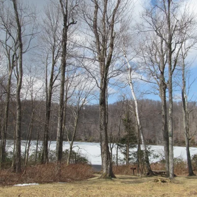
| Lanesborough to Cheshire | Runs along the entire western shore of Cheshire Reservoir. Open water views, waterfowl, and Mount Greylock reflected in still morning water. The most scenic section |
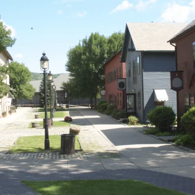
| Cheshire | Through the village of Cheshire — home of the famous 1,200-pound “Cheshire Cheese” pressed for President Jefferson in 1801. Small town New England at its best |
| Cheshire to Adams | Along the Hoosac River through wetlands and forest. Great blue herons, beaver dams, and the Hoosac Range rising to the east. Mount Greylock dominates the western skyline |
Best Time to Visit
| Season | Best For |
|---|---|
| Fall (Sep–Oct) | 🍂 Peak New England foliage. The Berkshires turn crimson and gold. The reservoir reflects the color. Best two weeks of the year |
| Summer (Jun–Aug) | ☀️ Perfect cycling weather. Long days. Swimming nearby. Berkshire cultural season in full swing |
| Spring (Apr–May) | Wildflowers along the trail. Migrating birds on the reservoir. Cool mornings, warm afternoons. Some wet sections drying |
| Winter (Dec–Mar) | Cross-country skiing and snowshoeing on the trail. Berkshire winter — cold and beautiful. Reservoir frozen. Mount Greylock snow-capped |
Frequently Asked Questions
What does “Ashuwillticook” mean?
“The pleasant river between the hills” — in the Mohican language. The name originally referred to the south branch of the Hoosac River. It’s one of the few rail-trails in America with a Native American name.
Is the trail really flat?
Yes — nearly flat for the entire 12.7 miles. It follows a former railroad grade with less than 2% grade. This makes it one of the most accessible trails in the Berkshires — suitable for families, casual cyclists, and people with mobility challenges.
Can I see Mount Greylock from the trail?
Yes — Mount Greylock (3,491 feet, Massachusetts’ highest peak) is visible for much of the trail. The best views are from the Cheshire Reservoir section, where the mountain rises above the water. On clear mornings, the reflection is spectacular.
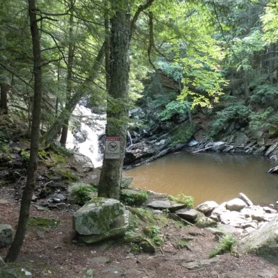
More parks nearby: Wahconah Falls State Park is a short drive away, while Mount Greylock State Reservation lies a short drive away.
🚴 The Pleasant River Between the Hills
12.7 miles of pavement, flat as a railroad should be. Cheshire Reservoir on one side. Mount Greylock on the other. A Mohican name that still fits perfectly, 300 years later.
Wildlife & Nature
Ashuwillticook Rail Trail — 12.7-mile paved trail following a former railroad corridor through the Berkshire Mountains along Cheshire Reservoir and Hoosac Lake. The trail’s wetlands, lakes, and forest support bald eagles, great blue herons, and beavers. Snapping turtles bask along the lakeside sections.
Nearby Attractions
Adams — northern terminus. Lanesborough — southern terminus. Mount Greylock SR — 5 miles west — the highest point in Massachusetts (3,491 ft). MASS MoCA — 10 miles north in North Adams.