Bogue Chitto State Park
🏆 Louisiana’s Adventure Playground — 1,760 acres along the Bogue Chitto River with river tubing, 25 miles of mountain bike trails, sandy swimming beaches, equestrian trails, Fricke’s Cave gorge, and a 200-foot water park
Why Bogue Chitto Is Louisiana’s Most Exciting State Park
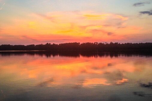
The name comes from the Choctaw language — “Bogue Chitto” means “big creek” — and that creek defines everything about this park. Located near Franklinton in Washington Parish, Bogue Chitto State Park spreads across 1,760 acres of rolling landscape where cypress-tupelo swamps meet hardwood forests, and a clear river cuts through sandy bluffs that feel more Appalachian than Deep South. This is Louisiana’s adventure park, offering 25 miles of nationally recognized mountain bike trails, river tubing, horseback riding, disc golf, and a water playground that makes it one of the best family destinations in the state.
River Tubing and Swimming
The Bogue Chitto River is the park’s star attraction in summer. From May through September, visitors float the river on rented tubes, drifting past white sandy beaches, overhanging hardwoods, and the occasional great blue heron fishing in the shallows. The river has natural dangers — submerged objects, strong currents, and no lifeguards — so river shoes and life vests are essential for families.
Beyond the river, the park features a 200-foot water park with water slides, spouts, and wooden waterfalls — a major draw for families with young children.
Trail System: Mountain Biking and Horseback Riding
| Trail Type | Distance | Difficulty | Highlights |
|---|---|---|---|
| Mountain Bike Trails | 25 miles | All levels | Skills park; maintained singletrack; nationally recognized |
| Equestrian Trails | 14 miles | Moderate | Wind through varied terrain; trailhead near Fricke’s Cave |
| Gorge Run Trail | 5 miles | Moderate | Swamps, bluffs, forests; Fricke’s Cave sandstone gorge |
| Nature Trails | 7+ miles | Easy | Interpretive; wildlife viewing; cypress swamp boardwalks |
Camping Options
| Option | Sites | Amenities | Best For |
|---|---|---|---|
| RV Sites | 50+ | Water, electric, sewer hookups | Full-service camping |
| Tent Sites | 30+ | Fire ring, table, nearby bathhouse | Traditional camping |
| Cabins | Multiple | Bluff-top; kitchen; A/C | Comfort camping; river views |
| Equestrian Camp | Designated area | Horse corrals; water access | Multi-day horseback trips |
| Group Camp | 1 area | Large groups; pavilion | Scout troops; family reunions |
Other Activities
| Activity | Details | Season |
|---|---|---|
| Fishing | 11 stocked lakes; bass, bream, catfish | Year-round |
| Disc Golf | 18-hole course; moderately difficult | Year-round |
| Kayaking/Canoeing | River paddling; seasonal rentals | May-Sept |
| Fricke’s Cave | Sandstone gorge with delicate formations | Year-round |
Best Time to Visit
| Season | Weather | Crowds | Best For |
|---|---|---|---|
| Spring (Mar-May) | 65-80°F | Moderate | Trail riding; river levels optimal; wildflowers |
| Summer (Jun-Aug) | 85-95°F | High | Tubing; water park; swimming; longest days |
| Fall (Sep-Nov) | 60-80°F | Low | Mountain biking; fall colors; fishing |
| Winter (Dec-Feb) | 40-60°F | Very Low | Mild hiking; birding; cabin getaways |
🚴 Louisiana’s Ultimate Outdoor Adventure
Tube the river, ride 25 miles of singletrack, explore a sandstone gorge, and camp on the bluffs above the Bogue Chitto.
Frequently Asked Questions
Is tubing available year-round?
No. River tubing and tube rentals are typically available from May through September, depending on water levels and weather conditions. The park’s water playground is also seasonal. Outside summer months, the park focuses on trail activities, fishing, and camping.
How difficult are the mountain bike trails?
The 25-mile trail system caters to all skill levels, from beginner-friendly rolling paths to technically challenging singletrack with roots and drops. A dedicated skills park allows riders to practice before hitting the trails. The system is nationally recognized and maintained by local volunteer trail crews.
What is Fricke’s Cave?
Fricke’s Cave is not a traditional cave but a narrow sandstone gorge with delicate rock formations carved by water erosion over millennia. It’s located along the equestrian trail system and is accessible by foot. The formations are fragile — visitors must stay on marked paths and avoid touching the rock walls.