Delta Junction
🏔️ Mile 1,422 — Where the Alaska Highway Ends and the Wilderness Begins — Delta Junction State Recreation Site at the official end of the Alaska Highway, Richardson Highway junction, 25 wooded campsites, Tanana River access, Delta River confluence, Trans-Alaska Pipeline viewpoint, Sullivan Roadhouse museum, Alaska Range views, Big Delta — Southeast Fairbanks Census Area, AK
You’ve driven 1,422 miles from Dawson Creek, British Columbia. Through the Yukon. Through the Wrangell Mountains. Past Tok. And now the road ends — or rather, it changes its name. At Delta Junction, the Alaska Highway officially terminates at the “Triangle” where it meets the Richardson Highway. There’s a monument, a visitor center, and a certificate that says you made it.
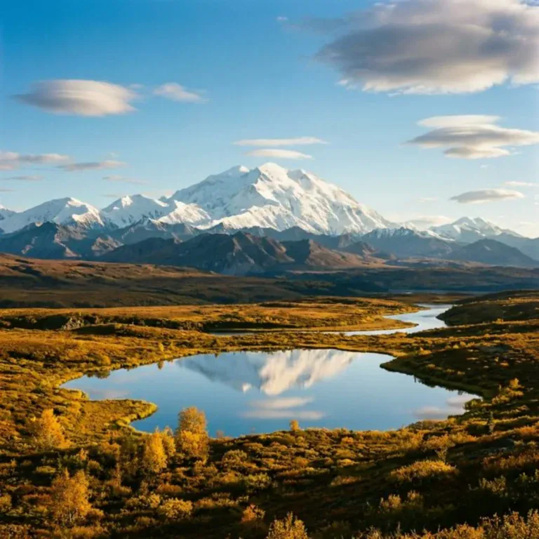
But Delta Junction isn’t just a highway terminus — it’s a gateway. The Tanana River sweeps past, wide and silty. The Alaska Range rises to the south. The Trans-Alaska Pipeline crosses the Tanana at a viewpoint 10 miles north. And the Delta State Recreation Site puts you in a campground where moose wander through on their way to the river.
What to See & Do
| Feature | Details |
|---|---|
| End of Alaska Highway | The official monument marking Mile 1,422 — the northern terminus of the Alaska Highway, built in 1942 as a military supply road during WWII. The visitor center sells certificates, stickers, and the satisfaction of having driven one of the world’s great road trips |
| Camping | 25 wooded campsites at Delta State Recreation Site — near the Richardson Highway (Mile 267). Pull-through and back-in sites suitable for RVs and tents. Water pump. Vault toilets. The campground is forested — birch and spruce. Moose are regular visitors |
| Trans-Alaska Pipeline | The 800-mile pipeline from Prudhoe Bay to Valdez crosses the Tanana River at Mile 275.4 of the Richardson Highway — a 10-minute drive north. The viewing area shows the pipeline spanning the river on an elevated bridge. One of the most accessible pipeline viewpoints in Alaska |
| Sullivan Roadhouse | The oldest surviving roadhouse in Interior Alaska (built 1905), originally on the Valdez-to-Fairbanks Trail. Moved to its current location near the visitor center. Now a museum — artifacts from the gold rush era and early Alaska transportation |
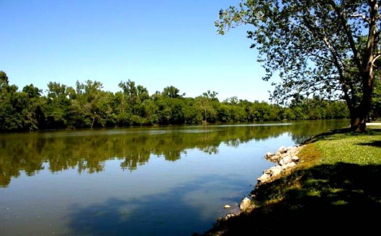
| Tanana River | One of Alaska’s major rivers — glacially fed, silty, and powerful. The Delta River confluences with the Tanana near town. Fishing for king salmon, silver salmon, grayling, and northern pike. The river is big, cold, and fast — respect it |
The Interior Alaska Setting
| Feature | Details |
|---|---|
| Alaska Range | The Alaska Range rises to the south — the same range that includes Denali (120 miles northwest). From Delta Junction on clear days, you can see massive peaks including Mount Hayes (13,832 ft) and Mount Deborah (12,339 ft). The light on the range at midnight in June is otherworldly |
| Interior Climate | Extreme continental: -40°F in winter, 90°F in summer. The temperature swing is among the largest in North America. Summer days are 20+ hours of daylight. Winter brings Northern Lights and deep cold |
| Agriculture | Delta Junction is one of Alaska’s few agricultural areas — the Delta Agricultural Project established farmland in the 1970s and 80s. Barley fields, bison ranches, and the Delta Bison Herd (about 500 free-roaming bison) make the landscape unique in Alaska |
| Big Delta SHP | Big Delta State Historical Park (Rika’s Roadhouse) is 8 miles north — a beautifully restored 1909 roadhouse on the Tanana River. Gardens, historical exhibits, and one of the most photographed buildings in Interior Alaska |
Best Time to Visit
| Season | Best For |
|---|---|
| Summer (Jun–Aug) | ☀️ 20+ hours of daylight. Warm (70–85°F). Salmon runs. The Alaska Range visible. Midnight sun. The Alaska Highway at its most driveable |
| Fall (Sep) | Northern Lights begin. Birch and aspen turning gold. The Alaska Range dusted with termination dust. Fewer mosquitoes. Quiet |
| Spring (May) | Ice break-up on the Tanana — a dramatic event. Snow melting. The road opening. Migratory birds arriving |
| Winter (Oct–Apr) | Northern Lights at their best. Extreme cold (-40°F possible). Limited services. For experienced winter travelers only |
Frequently Asked Questions
Is this really the end of the Alaska Highway?
Yes — officially, Mile 1,422. Historically, the Alaska Highway ran from Dawson Creek, BC, to Delta Junction, AK. The road continues north to Fairbanks as the Richardson Highway, but the “Alaska Highway” name ends here.
Will I see bison?
Possibly — the Delta Bison Herd (about 500 animals) roams freely in the area. They’re descendants of bison transplanted in the 1920s. They sometimes graze near the highway and agricultural fields. Drive carefully.
🏔️ 1,422 Miles From Dawson Creek. The Highway Ends. Alaska Begins.
A certificate says you made it. The Alaska Range says keep going. Moose wander through the campground. Free-roaming bison graze the barley fields. And the midnight sun hangs above peaks that have no name on any map.