
Dodge Point
🌤 Weather at Dodge Point by season
| Spring | Summer | Fall | Winter |
|---|---|---|---|
| 25–65 °F | 54–78 °F | 32–69 °F | 15–36 °F |
Each range runs from the coldest monthly average low to the warmest monthly average high in that season (1991-2020 climate normals), measured at Newcastle, 2 mi away, elevation 213 ft. Conditions at the park can differ from the station, especially where elevation differs — check a forecast before you go.
🌊 Maine’s Secret River Beach — Hidden Coves on the Damariscotta Where You Might Be the Only One — Dodge Point Public Reserved Land in Newcastle, Midcoast Maine, 521 acres on the Damariscotta River, 8,000 feet of tidal shoreline, Sand Beach, Pebble Beach, 5+ miles of hiking trails, old-growth pines, historic ice pond, kayak dock, birding, clamming — Lincoln County, ME
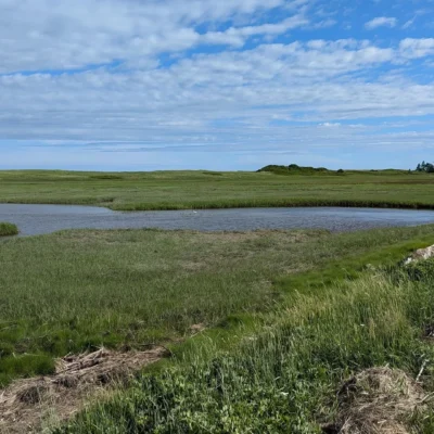
The Damariscotta River is tidal here — salt water pushes inland, filling pocket coves with clean, cold Maine water twice a day. Dodge Point sits on the western shore, a 521-acre preserve with three hidden beaches that most tourists driving Route 1 never know exist.
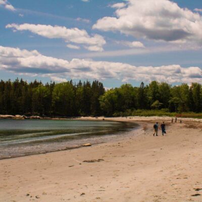
Sand Beach is exactly what it sounds like — a real sandy beach on a Maine river, accessible only by hiking through a managed forest of red pines and past stone walls from 19th-century farms. Pebble Beach is smoother. Brickyard Beach has the ruins. All three are tidal — arrive within two hours of low tide for maximum sand.
What to Do
| Activity | Details |
|---|---|
| Sand Beach | A genuine sandy beach on the Damariscotta River — tidal, so check the tide chart. At low tide: wide sand, warm (for Maine) shallows, and privacy. Most visitors don’t know it’s here. The hike in (0.5 miles via Shore Trail) keeps the crowds away |
| Hiking Trails | 5+ miles of well-marked trails: Old Farm Road (2-mile loop through red pine plantations and stone walls), Shore Trail (river access and beaches), Ravine Trail (moderate, through stream-cut ravines), Timber Trail (connects to River-Link system). All easy to moderate |
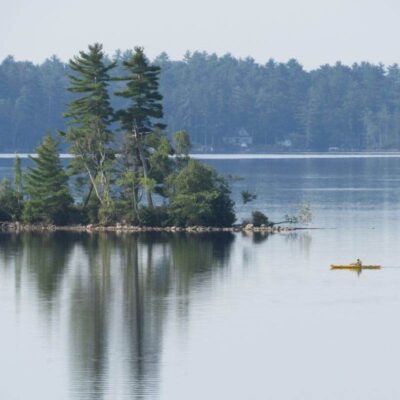
| Kayaking | Deep-water dock with floats on the Damariscotta — paddle up or downriver through one of Maine’s most beautiful tidal estuaries. The river is home to harbor seals, ospreys, and bald eagles. Paddle to the oyster farms visible at low tide |
| Birding | Ospreys nesting on the river. Bald eagles soaring. Great blue herons in the shallows. Egrets, cormorants, and migratory songbirds in the forest. The mix of river, forest, and meadow creates prime habitat |
| Clamming | Recreational clamming is possible at low tide — but check with the Newcastle Town Office first for red tide closures and regulations. Soft-shell clams in the mudflats. A Maine tradition |
The Midcoast Maine Setting
| Feature | Details |
|---|---|
| Damariscotta River | A tidal river connecting the interior to the Atlantic — salt water, seals, oysters, and the rhythm of twice-daily tides. The river is famous for its oyster farms and the annual Pemaquid Oyster Festival. The water is clean enough for commercial shellfish |
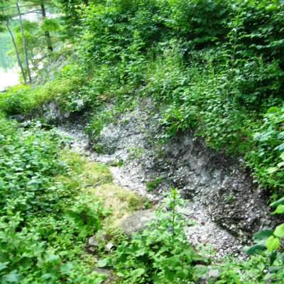
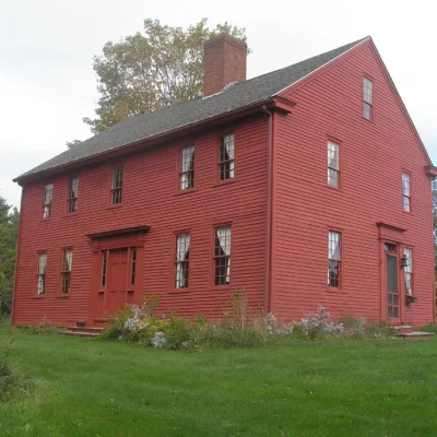
| Historic Landscape | Stone walls from 19th-century farms cross the forest. A historic ice pond — where ice was harvested and shipped to tropical ports — sits in the woods. The red pine plantations were planted as timber crops. The land tells 200 years of Maine working history |
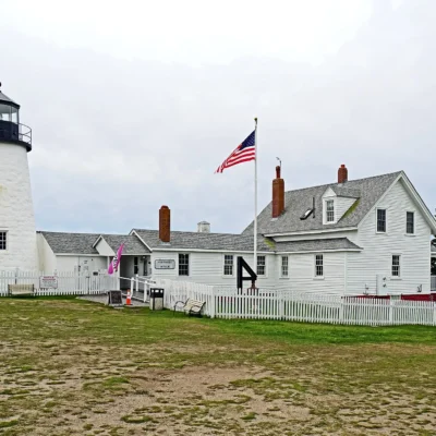
| Newcastle & Damariscotta | Twin villages on the river — one of the most charming communities on the Maine coast. Local restaurants, art galleries, and the famous Damariscotta oyster bars. The Pemaquid Peninsula and Pemaquid Point lighthouse are a short drive south |
| Day-Use Only | No camping. No fires. Carry in, carry out. Open sunrise to sunset. Free admission. The simplicity is the point — come, hike, find a beach, sit, leave no trace |
Best Time to Visit
| Season | Best For |
|---|---|
| Summer (Jul–Aug) | ☀️ Swimming at Sand Beach. Kayaking. Warmest water. Longest days. The beaches at their best. Check tides |
| Fall (Sep–Oct) | 🍂 Foliage reflecting in the tidal river. Fewer visitors. Oyster season. Mushroom foraging. The trails at their most colorful |
| Spring (May–Jun) | Wildflowers. Migrating birds. The forest greening. Cool but beautiful. The river waking up |
| Winter (Nov–Apr) | Cross-country skiing and snowshoeing. The forest quiet. Eagles fishing the open water. Hunting season — wear orange |
Frequently Asked Questions
Do I need to check tides?
Yes — arrive within 2 hours of low tide for maximum beach access. At high tide, the pocket beaches can be mostly underwater. Check a Damariscotta River tide chart before visiting.
Can I launch a kayak here?
Yes — a deep-water dock with floats provides kayak and boat access to the Damariscotta River. Paddle south toward the oyster farms or north toward Damariscotta Mills and the alewife run.
Nearby state parks: If you have extra time, Whaleback Shell Midden is a short drive away, and Fort Edgecomb State Historic Site is a short drive away.
🌊 Three Hidden Beaches. A Tidal River. Stone Walls in the Pines. This Is Midcoast Maine.
Hike through red pines past 200-year-old stone walls. Find a sandy beach on a tidal river. Watch ospreys dive for fish. Paddle to the oyster farms. And leave no trace — because the next person who finds this place deserves the same surprise you got.
Wildlife & Nature
Dodge Point — 521 acres on the Damariscotta River. The preserve’s mixed forest, saltwater shoreline, and freshwater ice pond support harbor seals, bald eagles, and great blue herons. Ancient oyster shell middens (up to 2,000 years old) line the shore — evidence of Native American harvesting.
Nearby Attractions
Newcastle — adjacent. Damariscotta — 3 miles north — famous for oyster farms. Pemaquid Point — 12 miles south.

🐾 Dogs & Pets at Dodge Point
- Pets allowed? statewide rule
- Pets are allowed at most Maine state parks year-round, including trails, but must be leashed, under the handler's physical control and never left unattended.
- Leash rule statewide rule
- Leash not exceeding 4 feet, under the physical control of the handler
- Beaches & swim areas statewide rule
- Pets are not allowed on state park beaches April 1 through September 30; leashed pets are welcome on beaches October 1 through March 31
- Statewide exceptions statewide rule
- No pets allowed at Sebago Lake State Park campground; park staff may assign pet owners to less congested camping areas
Are dogs allowed at Dodge Point?
Pets are allowed at most Maine state parks year-round, including trails, but must be leashed, under the handler's physical control and never left unattended. Individual parks can post stricter rules — check signage on arrival.
Rules verified July 2026 via maine.gov. More: Maine state parks guide · Dog rules in all 50 states compared
Park Location
Plan your gear for Dodge Point
From our editorial guides, matched to this park’s activities:
Top Tours & Activities Near Camden
 from $15
 from $125
 from $20