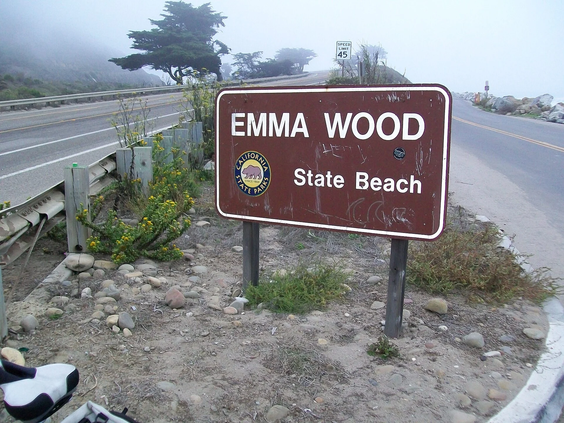
🌊 Where the Mountains Meet the Pacific — Camping on the Beach Between Ventura and the Rincon — Emma Wood State Beach north of Ventura, California, beachfront camping, Pacific Ocean, Ventura River estuary, surfing, tide pools, coastal bike path, Channel Islands views, Highway 101 coastal corridor, RV and tent camping — Ventura County, CA
Highway 101 hugs the coast here — mountains rising on one side, the Pacific breaking on the other, and Emma Wood State Beach squeezed in between. This is the stretch between Ventura and the legendary Rincon surf break, where Southern California’s coast narrows to a dramatic corridor of waves, mountains, and sky.
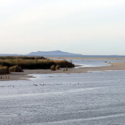
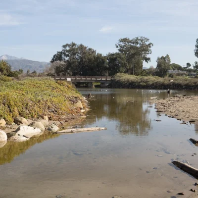
The campground puts you on the beach. Not near the beach. Not a walk to the beach. On it. The surf breaks right in front of your campsite. The Channel Islands float on the horizon. And the Ventura River estuary next door brings birds, fish, and the kind of coastal ecology that California used to have everywhere before the developers arrived.
What to Do
| Activity | Details |
|---|---|
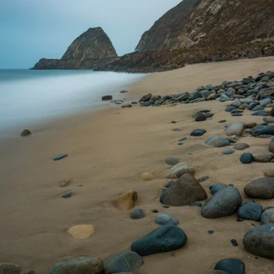
| Beach Camping | Campsites directly on the cobblestone beach — some of the most dramatic beachfront camping in Southern California. The waves are your soundtrack. The Channel Islands are your view. Self-contained RVs and some tent sites. No hookups — the beach doesn’t negotiate with luxury |
| Surfing | Emma Wood has a consistent point/reef break that works on west and northwest swells. The nearby Rincon Point — “Queen of the Coast” — is one of the most famous right-hand point breaks in the world, just a short drive north. Surfers stage from Emma Wood |
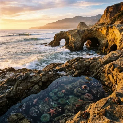
| Tide Pools | Rocky outcrops at low tide reveal pools filled with anemones, sea stars, hermit crabs, and urchins. The tide pool area is accessible from the beach. Check tide charts — arrive 1–2 hours before low tide for the best exploring |
| Ventura River Estuary | The Ventura River meets the ocean at the south end of the beach — creating a tidal estuary that attracts herons, egrets, shorebirds, and migrating raptors. The estuary is a California Important Bird Area. Birdwatching is excellent year-round |
| Channel Islands Views | The Channel Islands — Anacapa, Santa Cruz, Santa Rosa, and San Miguel — line the horizon 11–25 miles offshore. On clear days (common), the islands look close enough to swim to. The islands are a national park, accessible by boat from Ventura Harbor |
The Ventura Coast
| Feature | Details |
|---|---|
| Mountains to Ocean | The Transverse Ranges rise abruptly behind the beach — creating a narrow coastal strip where mountains and ocean exist side by side. The geology is dramatic: tilted sedimentary layers, oil seeps, and the tectonic forces that built California visible in every cliff |
| Rincon Proximity | The Rincon Point surf break is just north — considered one of the best waves in the world. When the Rincon is firing on a winter northwest swell, the energy ripples down to Emma Wood. Surfers have been riding this stretch since the 1930s |
| Bike Path | The Ventura coastal bike path connects Emma Wood to downtown Ventura — ride along the coast, past the fairgrounds, and into the harbor district. The path is flat, scenic, and perfect for cruisers |
| Climate | Southern California Mediterranean — warm, dry summers and mild winters. Beach weather from April through November. The morning marine layer burns off by mid-morning, revealing blue sky. 300+ days of sunshine |
Best Time to Visit
| Season | Best For |
|---|---|
| Fall (Sep–Nov) | ☀️ Warmest water. Clearest air (Santa Ana winds). Fewer crowds. Best Channel Islands visibility. Surf starting to build |
| Winter (Dec–Feb) | 🏄 Best surf — northwest swells light up the point breaks. Whale migration offshore. Dramatic skies. Camping in 60°F weather |
| Summer (Jun–Aug) | Beach season. Warmest days. Fog possible in June. Channel Islands trips. The coast busiest |
| Spring (Mar–May) | Wildflowers on the mountains above. Gray whale migration ending. Water warming. The coast greening |
Frequently Asked Questions
Is the beach sandy?
Mostly cobblestone — smooth, rounded river rocks. This is characteristic of the Ventura coast. Bring a good sleeping pad if tent camping. The cobblestones are beautiful but not soft. Sand patches exist at low tide.
Can I walk to the Rincon from here?
No — the Rincon is about 5 miles north. Drive along Highway 101 to the Rincon Beach County Park access. But Emma Wood’s own surf break is worth riding, and the crowds are far less intense than the Rincon lineup.
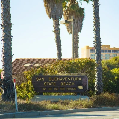
Make it a road trip: Pair a visit with San Buenaventura State Beach (a short drive away) or McGrath State Beach (a short drive away).
Camping reservations: Book campsites and cabins for California state parks online at reservecalifornia.com.
🌊 Camp on the Beach. Surf at Dawn. Watch the Channel Islands Glow at Sunset.
Mountains behind you. The Pacific in front. The Channel Islands on the horizon. And a campsite on the cobblestone beach where the waves break 50 feet from your tent. This is the Ventura coast — where California compresses mountains, ocean, and surf into one narrow, perfect strip.
Wildlife & Nature
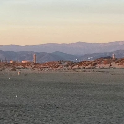
Emma Wood State Beach — at the Ventura River mouth — features a rocky beach backed by the Southern Pacific Railroad tracks (trains rumble past!). The Ventura River estuary provides critical habitat for steelhead trout (federally endangered Southern California DPS). Snowy plovers (federally threatened) nest on the beach. Brown pelicans roost on the rocks. Harbor seals haul out at the river mouth.
Nearby Attractions
Ventura — 3 miles south — has the San Buenaventura Mission, Main Street dining, and the Channel Islands NP Visitor Center. Ojai — 15 miles inland — has art galleries, spas, and the “Pink Moment” sunset on the Topatopa Mountains. Rincon Point — 5 miles north — has legendary surfing. Channel Islands — visible offshore.

Park Location

Top Tours & Activities Near Ventura
 from $125
 from $145
 from $320