
🏆🏆🏆🏆🏆 1652 Boundary Stone — A 1652 boundary marker inscribed in a lakeside boulder — one of the oldest surviving landmarks in America
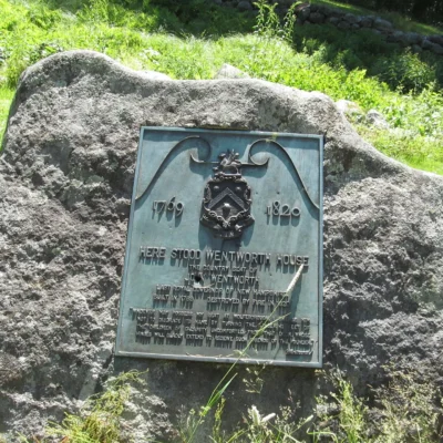
Endicott Rock State Historic Site in Laconia preserves a boulder inscribed in 1652 by surveyors from Massachusetts Bay Colony who were sent to find the source of the Merrimack River and establish the colony’s northern boundary. The inscription “JOHN ENDICOT GOV” marks where they determined the river’s headwaters began — at the outlet of Lake Winnipesaukee. This rock is one of the oldest surviving boundary markers in North America, predating even the Salem witch trials by 40 years.
Visitor Information
| Detail | Information |
|---|---|
| Location | Laconia (Weirs Beach), Belknap, NH |
| Entry Fee | Free |
| Date | 1652 — 374 years old! |
| Inscription | “JOHN ENDICOT GOV” |
Frequently Asked Questions
Why did they inscribe the rock?
Massachusetts Bay Colony’s 1629 charter granted all land within 3 miles of the Merrimack River’s source. In 1652, surveyors traced the river to Lake Winnipesaukee and inscribed this boulder to stake their claim — establishing a boundary that shaped New England’s political geography for centuries.
How many islands does Winnipesaukee have?
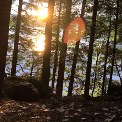
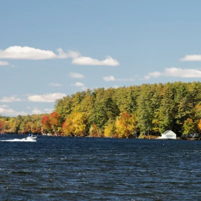
Lake Winnipesaukee has 253 islands (officially) — some large enough for year-round homes, others barely above water. The lake’s name comes from Abenaki and means various things depending on translation — “Beautiful Water in a High Place” or “Smile of the Great Spirit.” At 72 square miles, it’s New Hampshire’s largest lake and one of the most popular summer destinations in New England.
Make it a road trip: Pair a visit with Ellacoya State Park (a short drive away) or Forest Lake State Park (a short drive away).
🪨 Visit Endicott Rock SHS
1652 — oldest boundary marker in America, carved at Lake Winnipesaukee.
About Endicott Rock
Endicott Rock State Historic Site in Laconia preserves a glacial boulder inscribed by surveyors in 1652 to mark the northern boundary of Massachusetts Bay Colony — one of the oldest permanent boundary markers in America. The inscription “E·I·S·I·W” and “1652” marks where the Merrimack River exits Lake Winnipesaukee. Governor John Endicott commissioned the survey. The rock is now partially submerged by changes in lake level.
Things to Do
Viewing the 1652 boundary inscription (one of America’s oldest), learning about colonial boundary disputes, fishing, and exploring Laconia’s lakefront.
Insider Tips
Colonial boundary: Endicott Rock (1652) marks one of the oldest known boundary markers in America — carved by surveyors from the Massachusetts Bay Colony to establish the northern boundary of their charter. Pro tip: The rock sits at the outlet of Lake Winnipesaukee — surveyors followed the Merrimack River to find the “head” of the river. Lake Winnipesaukee: New Hampshire’s largest lake covers 72 square miles with 253 islands.
Best Time to Visit
Summer: Lake Winnipesaukee season. Fall: Lakeside foliage. Year-round: Rock and marker accessible. Winter: Ice fishing on Winnipesaukee.
Wildlife & Nature
Endicott Rock State Historic Site — at Weirs Beach on Lake Winnipesaukee — preserves a glacial boulder inscribed by surveyors in 1652 marking the boundary between Massachusetts Bay Colony and the northern wilderness. This rock — one of the oldest boundary markers in North America — is now partially submerged at the lake outlet. The site provides views of the Winnipesaukee outlet into the Paugus Bay channel. Ring-billed gulls and common terns fish the outlet.
Nearby Attractions
Weirs Beach — adjacent — has arcades, the M/S Mount Washington cruise ship, and the Winnipesaukee Scenic Railroad. Laconia — 3 miles south — hosts Motorcycle Week. Lake Winnipesaukee — 72 square miles with 253 islands — is NH’s largest lake. Meredith — 5 miles north — has shops and restaurants.

Park Location
Top Tours & Activities Near New Hampshire
 from $85
 from $150
 from $40