
🌤 Weather at King’s Island Coop Wildlife Management Area by season
| Spring | Summer | Fall | Winter |
|---|---|---|---|
| 28–72 °F | 58–85 °F | 33–76 °F | 19–41 °F |
Each range runs from the coldest monthly average low to the warmest monthly average high in that season (1991-2020 climate normals), measured at Hartford Bradley International Airport, 4 mi away, elevation 190 ft. Conditions at the park can differ from the station, especially where elevation differs — check a forecast before you go.

King’s Island Coop Wildlife Management Area is a 174-acre cooperative hunting area on land owned by Eversource in Enfield and Suffield, Hartford County, listed by the Connecticut Department of Energy and Environmental Protection (DEEP).
Visitor Information
| Detail | Information |
|---|---|
| Location | Parsons Road, Enfield, CT 06082 (DEEP hunting area map, U.S. Census) |
| Size | 174 acres (DEEP hunting area map, as of October 2026) |
| Type | Cooperative hunting area on Eversource land (DEEP) |
| Entry Fee | No entrance fee is listed by DEEP (as of October 2026) |
| Hunting | State hunting area, waterfowl only (DEEP, as of October 2026) |
| Boat Launch | Kings Island Boat Launch, Connecticut River, trailered (DEEP) |
Frequently Asked Questions
Is hunting allowed at King’s Island Coop WMA?
Yes. DEEP’s hunting-area data (as of October 2026) list 174 acres of King’s Island Coop WMA as a state hunting area. It is open for waterfowl hunting only. Check the DEEP hunting area map and the current Connecticut Hunting and Trapping Guide for season dates before you go.
Where do I park for King’s Island Coop WMA?
Access is from the Kings Island Boat Launch on Parsons Road in Enfield (DEEP gives the address as 49 Parsons Road), a trailered launch on the Connecticut River. DEEP asks visitors not to trespass on the railroad tracks. (DEEP hunting area map, as of October 2026)
Who owns King’s Island Coop WMA?
Eversource owns the land. DEEP lists it as a cooperative wildlife management area that is open to waterfowl hunting only. For rules beyond hunting, contact DEEP’s Wildlife Division (as of October 2026).
About King’s Island Coop WMA
DEEP’s mapped property boundary lies in Enfield and Suffield, across the town line between Enfield and Suffield.
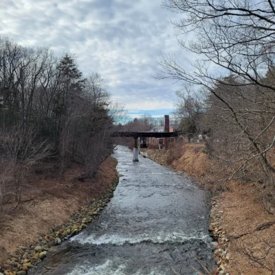
DEEP’s hydrography data show Beemans Brook and Connecticut River on or along the property. The 2021 National Land Cover Database (NLCD) maps the area as 84 percent forest, 3 percent wetland, and 11 percent open water.
Things to Do
Hunters can use the area for waterfowl hunting under DEEP’s rules for this area. DEEP lists the Kings Island Boat Launch as a trailered launch, so you can put in a boat or kayak here. From the launch you can fish the Connecticut River under Connecticut’s fishing rules and license requirements.
Nearby Attractions
Scantic River State Park, a 773-acre state park, is about 2 miles east. Newgate Wildlife Management Area, a 446-acre wildlife management area, is about 6 miles west. Windsor Meadows State Park, a 154-acre state park, is about 8 miles south. Shenipsit State Forest, a 7,159-acre state forest, is about 8 miles east. Distances are straight-line between the DEEP property boundaries; acreages are DEEP’s mapped figures.

Park Map
Plan your gear for King’s Island Coop Wildlife Management Area
From our editorial guides, matched to this park’s activities: