🏔️ Vermont’s Little Grand Canyon — Home to the 165-foot Quechee Gorge (Vermont’s deepest), with hiking trails descending to the Ottauquechee River floor, 45 tent/RV sites, 7 lean-tos, 6 cabins, disc golf, trout fishing, and a front-row seat to New England’s most dramatic fall foliage display — all 10 minutes from charming Woodstock
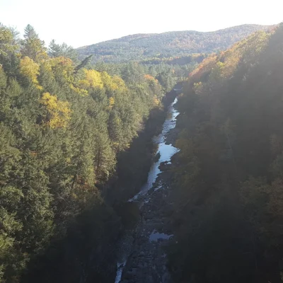
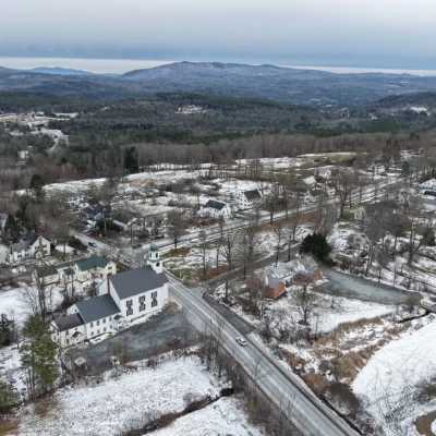
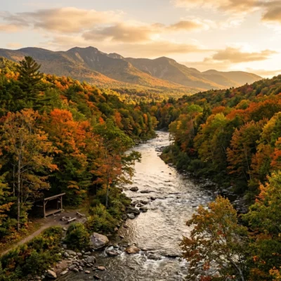
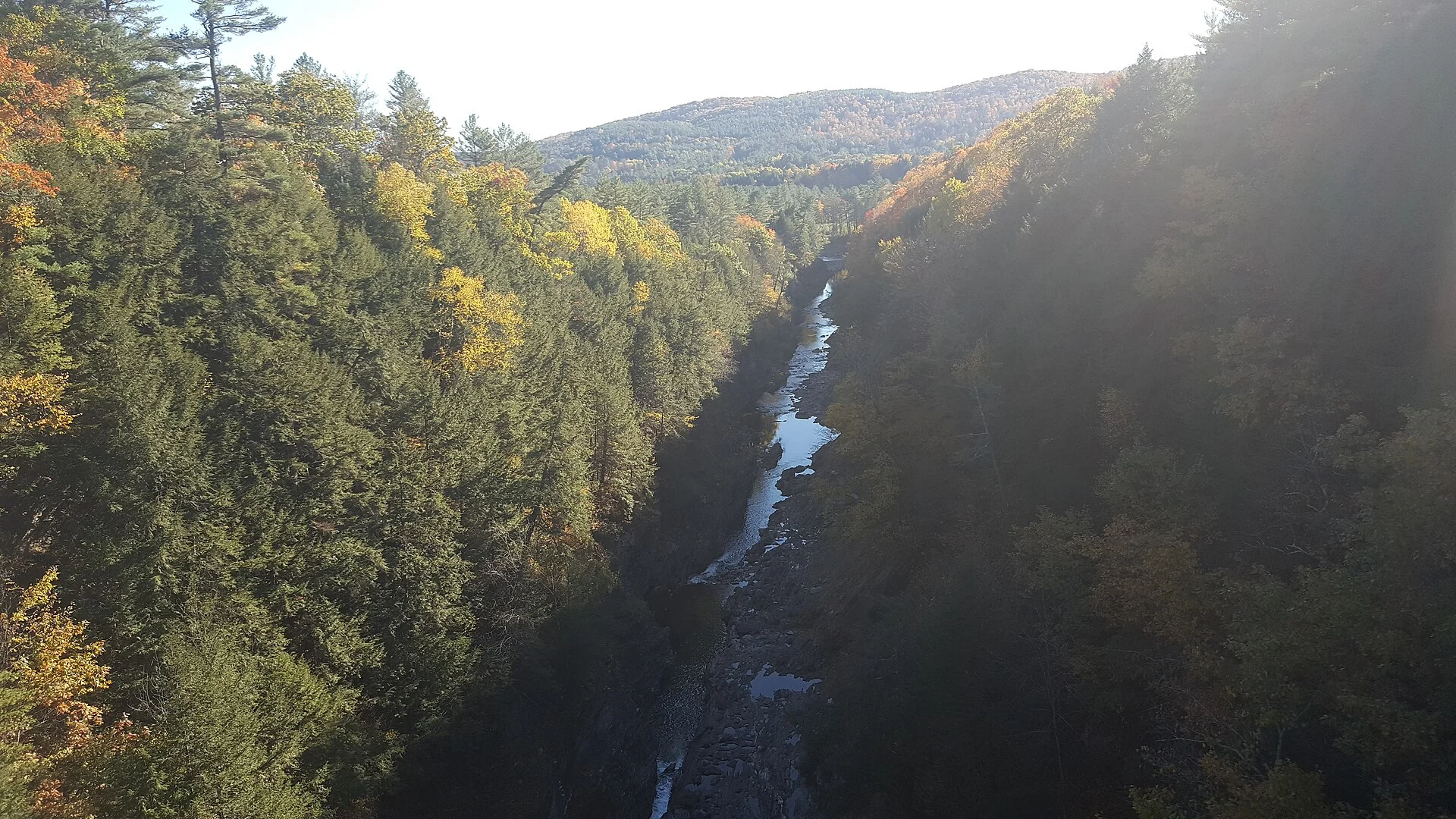
On the eastern edge of Vermont’s Green Mountains, where the Ottauquechee River has spent 13,000 years carving through ancient bedrock left behind by retreating glaciers, a chasm opens in the earth that has earned the nickname “Vermont’s Little Grand Canyon.” At 165 feet deep, Quechee Gorge is the deepest gorge in Vermont — a dramatic, sheer-walled canyon with a dark river threading its floor and walls that record geological forces most New England landscapes have long since erased.
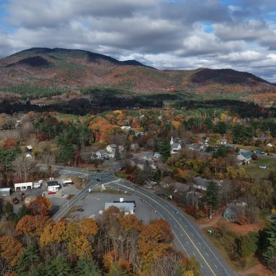
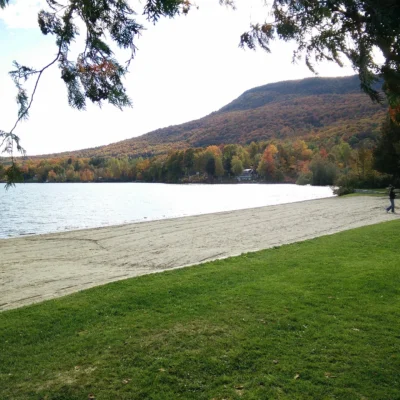
Quechee State Park wraps around the gorge and provides access to it via a scenic, accessible trail that descends from the Route 4 bridge (where most visitors get their first jaw-dropping view straight down into the chasm) to the river floor below. But the park is far more than a gorge overlook. It’s a full-service campground with 45 sites, lean-tos, and cabins, surrounded by the kind of Vermont landscape that peaks in October when the hardwood forests ignite in a spectrum of red, orange, and gold that draws visitors from around the world. The park sits just 10 minutes from Woodstock — consistently ranked among the most beautiful small towns in America — and minutes from Simon Pearce glassblowing, the Billings Farm, and Vermont’s only national park (Marsh-Billings-Rockefeller).
Quechee Gorge
| Feature | Details |
|---|---|
| Depth | 165 feet — Vermont’s deepest gorge |
| Age | ~13,000 years (carved by glacial meltwater) |
| River | Ottauquechee River |
| Best View | Route 4 bridge — look straight down into the chasm |
| Nickname | “Vermont’s Little Grand Canyon” |
Trails
| Trail | Distance | Difficulty | Highlights |
|---|---|---|---|
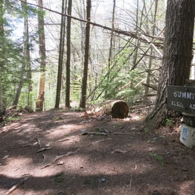
| Quechee Gorge Trail | ~1.3 miles RT | Moderate | Descends to the river floor — gorge views |
| Bridge Overlook | Walk-up | Easy | Dramatic view straight down 165 feet |
Tips: The trail to the bottom is moderate but involves steep, rocky sections. Footing can be slippery when wet. The payoff is standing at the river level and looking up at 165 feet of sheer rock walls on either side.
Fishing
| Species | Notes |
|---|---|
| Brook Trout | Native Vermont species — cold water, catch-and-release encouraged |
| Rainbow Trout | Stocked seasonally |
| Brown Trout | Elusive, deep pools |
Camping and Lodging
| Type | Quantity | Details |
|---|---|---|
| Tent/RV Sites | 45 | No hookups; flush toilets, hot showers |
| Lean-Tos | 7 | Three-sided shelters with platform |
| Cabins | 6 | Rustic but comfortable |
| Amenities | — | Dump station, play field, coin showers |
Activities Beyond Hiking
- Disc Golf Course
- Volleyball
- Horseshoes
- Seasonal Nature Programs — ranger-led interpretive walks
- Picnicking
Nearby — Woodstock and Quechee Village
- Woodstock: One of America’s most charming New England villages — covered bridge, village green, local shops (10 min)
- Simon Pearce: Glassblowing demonstrations, flagship store, restaurant overlooking a waterfall (5 min)
- VINS Nature Center: Forest canopy walk, birds of prey exhibits (5 min)
- Marsh-Billings-Rockefeller NHP: Vermont’s only national park — historic farm, trails (10 min)
- Billings Farm & Museum: Working farm since 1871, seasonal festivals (10 min)
Best Time to Visit
| Season | Highlights |
|---|---|
| Fall (Sep-Oct) | 🍁 Peak foliage — world-class colors in the gorge and surrounding forest |
| Summer (Jun-Aug) | Full park open, swimming in river, nature programs |
| Spring (Apr-May) | Snowmelt swells the river — dramatic gorge views, wildflowers |
Essential Visitor Information
| Detail | Information |
|---|---|
| Address | 5800 Woodstock Road, Hartford, VT 05001 |
| Season | Memorial Day weekend – second Monday in October |
| Hours | 10 AM – sunset |
| Fees | Day-use and camping fees apply (vtstateparks.com) |
Getting There
- From Woodstock: 10 minutes east on Route 4
- From Burlington: 90 miles south (~1 hour 45 minutes)
- From Boston: 150 miles northwest (~2 hours 30 minutes)
- From New York City: 250 miles north (~4 hours 15 minutes)
Wildlife & Nature
Quechee SP — adjacent to Quechee Gorge — “Vermont’s Little Grand Canyon” — a 165-foot-deep gorge carved by the Ottauquechee River through schist rock since the last Ice Age. The gorge’s cliffs, river, and forest support peregrine falcons, brook trout, and timber rattlesnakes.
Nearby Attractions
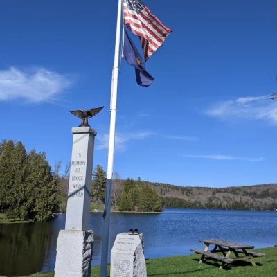
Quechee — adjacent. Quechee Gorge Village — adjacent. Woodstock — 5 miles west — one of America’s prettiest villages. Billings Farm & Museum — 5 miles west. Simon Pearce glassblowing — in Quechee.
How deep is Quechee Gorge?
Quechee Gorge is 165 feet deep — making it the deepest gorge in Vermont. It was carved approximately 13,000 years ago by the massive force of glacial meltwater as the last Ice Age glaciers retreated. The best view is from the Route 4 bridge, where you can look straight down into the chasm. A 1.3-mile round-trip trail descends from the rim to the river floor at the bottom.
When is the best time to see fall foliage at Quechee?
Peak fall foliage at Quechee State Park typically occurs in late September through mid-October. The gorge walls framed by blazing maples, birches, and oaks create one of the most dramatic fall color displays in all of New England. Visit on a weekday if possible — the Route 4 bridge overlook and parking can get very crowded on peak-color weekends. Book camping well in advance for October stays.
Nearby state parks: If you have extra time, Quechee Gorge State Park is a short drive away, and Quechee State Park is a short drive away.
Camping reservations: Book campsites and cabins for Vermont state parks online at vtstateparks-visit.com.

🐾 Dogs & Pets at Quechee State Park
- Pets allowed? statewide rule
- Pets are allowed at all Vermont State Parks campgrounds and on trails unless otherwise posted, but are not permitted on beaches or in most picnic areas.
- Leash rule statewide rule
- Leash shorter than 10 ft required (or pet safely confined) at all times
- Beaches & swim areas statewide rule
- Pets are not permitted on beaches; limited exceptions let pets use the far side of the beach away from swim areas at Branbury, Lake Shaftsbury and Silver Lake
- Cabins & lodging statewide rule
- Pets are permitted in designated pet-friendly cabins only (full list on the Vermont State Parks cabins page); cottages do not allow pets
- Statewide exceptions statewide rule
- Pets allowed in picnic areas at Allis, Camp Plymouth, Elmore, Kill Kare, Knight Point, Lake Shaftsbury, Mt. Philo, Osmore Pond and Owl's Head; at Camp Plymouth pets may swim only at the cartop boat launch; current rabies vaccination expected
Are dogs allowed at Quechee State Park?
Pets are allowed at all Vermont State Parks campgrounds and on trails unless otherwise posted, but are not permitted on beaches or in most picnic areas. Individual parks can post stricter rules — check signage on arrival.
Rules verified July 2026 via vtstateparks.com. More: Vermont state parks guide · Dog rules in all 50 states compared
Park Location
Plan your gear for Quechee State Park
From our editorial guides, matched to this park’s activities: