🏆 Cumberland Plateau Streamhead — Headwater stream ecology and sandstone geology
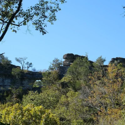
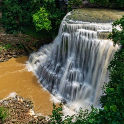
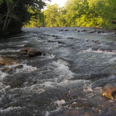
Dry Branch State Natural Area protects a headwater stream system on the Cumberland Plateau, preserving the delicate ecology of a streamhead community. These first-order streams are critical for water quality downstream and support salamander species adapted to the clean, cold headwater habitats. The site’s sandstone geology creates small cascades and rock formations along the branch.
Visitor Information
| Detail | Information |
|---|---|
| Location | Cumberland Plateau, TN |
| Entry Fee | Free |
| Habitat | Headwater stream, sandstone |
| Wildlife | Salamander habitat |
Frequently Asked Questions
Is there trail access?
State Natural Areas vary in trail availability. Check with Tennessee Division of Natural Areas for current access information. The terrain may be rugged and unmarked.
What is the Highland Rim?
The Highland Rim is a geological plateau encircling Middle Tennessee’s Central Basin — imagine a raised ring of forested hills surrounding Nashville. It formed from differential erosion — harder rock resisted erosion while softer rock weathered away to form the basin. The rim supports distinct plant communities adapted to its thin, acidic soils.
Keep exploring: The closest neighbors are Langford Branch State Natural Area (a short drive away) and Overbridge State Natural Area (a short drive away).
💧 Visit Dry Branch SNA
Headwater stream ecology on the Cumberland Plateau — salamander habitat and sandstone cascades.
About Dry Branch
Dry Branch State Natural Area protects a forested creek corridor in Tennessee’s Highland Rim. The area preserves riparian forest along a seasonal stream — the “dry branch” flows during wet periods but may reduce to isolated pools in summer. The forest supports diverse amphibian populations that depend on these intermittent waterways.
Things to Do
Hiking along the creek corridor, wildlife observation (especially salamanders — Tennessee has more salamander species than any other state), birdwatching, and spring wildflower viewing.
Insider Tips
Highland Rim nature: Dry Branch protects upland forest on Tennessee’s Highland Rim — the geological shelf surrounding the Central Basin. Pro tip: The Highland Rim’s chert-rich soil creates unique plant communities — poverty oats, blazing star, and prairie grasses persist in thin-soiled openings. Geology: The Highland Rim formed 350 million years ago as an ancient seabed — fossil crinoids and brachiopods are common in the limestone.
Best Time to Visit
Spring: Wildflower season. Fall: Understated but beautiful foliage. Summer: Shaded hiking. Winter: Fossil hunting in exposed rock.