Complete Guide: Valley of Fire State Park — Nevada’s oldest and largest state park — 40,000 acres of blazing red Aztec sandstone, 3,000-year-old petroglyphs, the iconic Fire Wave trail, and two campgrounds — just 50 miles northeast of Las Vegas.
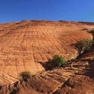
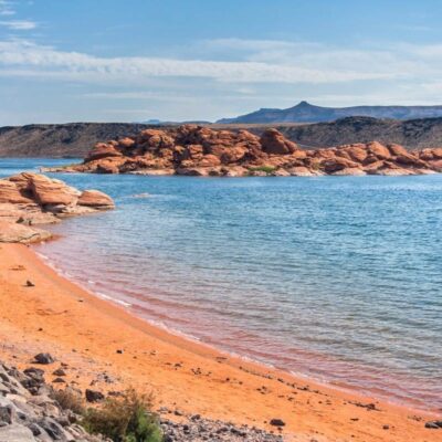
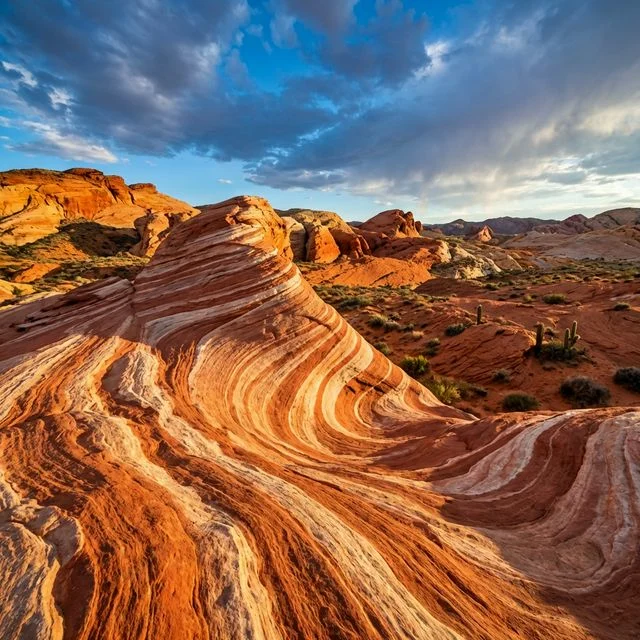
Valley of Fire State Park is Nevada’s most spectacular natural wonder — 40,000 acres of brilliant red, orange, and pink Aztec sandstone formations sculpted by 150 million years of erosion. Located just 50 miles northeast of Las Vegas near Overton, it’s the state’s oldest park (dedicated 1935) and one of the most visually stunning landscapes in the American Southwest. Ancient Puebloan petroglyphs, petrified wood, and otherworldly rock formations make this a must-visit destination.
Visitor Information
| Detail | Information |
|---|---|
| Location | ~50 mi NE of Las Vegas, near Overton, NV |
| Size | 40,000 acres |
| Admission | $10/vehicle (Nevada residents), $15/vehicle (non-residents) |
| Hours | Sunrise to sunset (visitor center: 8:30 AM–4:30 PM) |
| Campgrounds | Atlatl Rock (44 sites, hookups) + Arch Rock (29 sites) |
Must-See Highlights
| Feature | Description | Access |
|---|---|---|
| Fire Wave | Striped red/white sandstone wave formation | 1.2 mi RT — easy/moderate (closed summer) |
| Atlatl Rock | Ancient petroglyphs — metal staircase to viewing platform | Short walk — accessible |
| Mouse’s Tank / Petroglyph Canyon | Hundreds of 3,000-year-old petroglyphs | 0.75 mi RT — easy canyon walk |
| White Domes | Multicolored rock formations + movie set ruins | 1.25 mi loop (closed summer) |
| Elephant Rock | Natural rock arch resembling an elephant | Roadside — short walk |
Camping
| Campground | Sites | Features |
|---|---|---|
| Atlatl Rock | 44 | Electric/water hookups, flush toilets, hot showers, dump station |
| Arch Rock | 29 | Vault toilets — more scenic, rustic |
Activities
| Activity | Details |
|---|---|
| Hiking | Fire Wave, White Domes, Mouse’s Tank — seasonal closures |
| Scenic Driving | Valley of Fire Highway — stunning formations |
| Petroglyphs | Atlatl Rock, Petroglyph Canyon — 3,000+ years old |
| Camping | 73 total sites — reserve via Reserve Nevada |
| Photography | World-class desert landscape photography |
Frequently Asked Questions
When is the best time to visit Valley of Fire?
October through April. Summer temperatures regularly exceed 110°F, and popular trails (Fire Wave, White Domes, Pastel Canyon) are closed from mid-May through September 30. Spring and fall offer perfect hiking weather with open trails and dramatic light for photography.
How far is Valley of Fire from Las Vegas?
About 50 miles northeast — roughly a 1-hour drive via I-15 North. It’s one of the best day trips from Las Vegas and easily combined with the Lost City Museum in Overton.
Are the petroglyphs real?
Yes — the petroglyphs at Atlatl Rock and Petroglyph Canyon (Mouse’s Tank Trail) are estimated to be over 3,000 years old, created by ancient Puebloan peoples. They are among the best-preserved rock art sites in the Southwest. Never touch, trace, or damage the petroglyphs.
Make it a road trip: Pair a visit with Old Las Vegas Mormon Fort State Historic Park (within about an hour’s drive) or Ice Age Fossils State Park (within about an hour’s drive).

🐾 Dogs & Pets at Valley of Fire State Park
- Pets allowed? statewide rule
- Leashed pets are welcome at most Nevada state parks.
- Leash rule statewide rule
- Leash no longer than 6 feet required.
- Beaches & swim areas statewide rule
- Pets are not permitted at swim beaches; notably pets are banned at Sand Harbor (Lake Tahoe) April 15 through October 15.
- Statewide exceptions statewide rule
- Pets prohibited on certain trails in the Spooner Management Area; park supervisors may close additional areas to pets.
Are dogs allowed at Valley of Fire State Park?
Leashed pets are welcome at most Nevada state parks. Individual parks can post stricter rules — check signage on arrival.
Rules verified July 2026 via parks.nv.gov. More: Nevada state parks guide · Dog rules in all 50 states compared
Park Location
Plan your gear for Valley of Fire State Park
From our editorial guides, matched to this park’s activities: