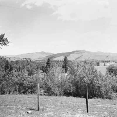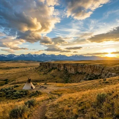
🌲 Where Lewis and Clark Held Council — A Cottonwood Grove on the Clark Fork River — Council Grove State Park near Missoula, Montana, historic Lewis and Clark campsite on the Clark Fork River, ponderosa pine and black cottonwood grove, fishing, picnicking, interpretive site, Corps of Discovery September 1805, Bitterroot Mountains backdrop — Missoula County, MT
On September 9, 1805, Captain William Clark and the Corps of Discovery camped in a grove of massive cottonwood trees along the Clark Fork River. They held council with the Salish people — a meeting that would shape the course of the expedition and the future of the American West. The grove still stands. The river still flows. And the mountains the expedition crossed the next morning are still visible from the same spot.
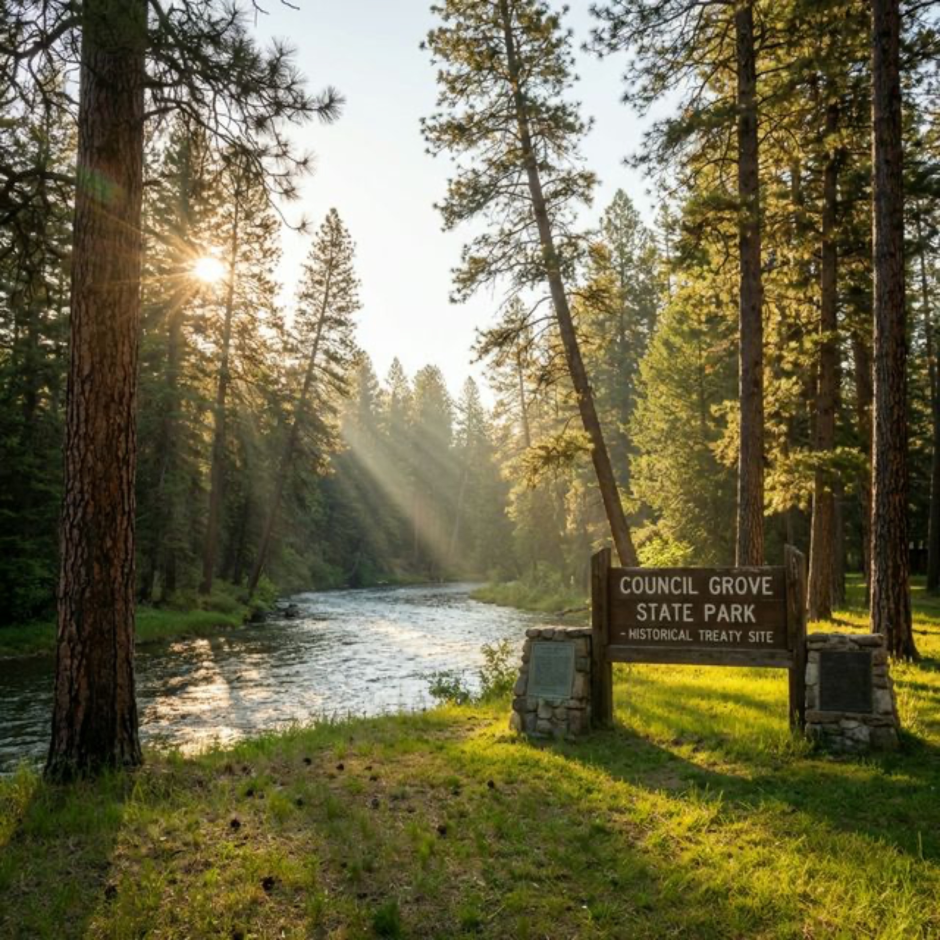
Council Grove State Park preserves the actual site of that meeting — a shaded cottonwood and ponderosa pine grove on the banks of the Clark Fork River, 10 miles west of Missoula. This isn’t a reconstructed historical site or a museum with plaques. It’s the place itself — the same trees (cottonwoods can live 200+ years), the same river, the same view of the Bitterroot Mountains.
What to See & Do
| Feature | Details |
|---|---|
| Historic Site | Interpretive signs describe the Lewis and Clark expedition’s September 1805 camp and their council with the Flathead (Salish) people. The meeting was peaceful — the Salish provided horses and guidance for the expedition’s crossing of the Bitterroot Mountains |
| The Grove | Ancient black cottonwood and ponderosa pine trees shade the riverbank. Some cottonwoods are enormous — 6+ feet in diameter. The grove creates a natural cathedral along the river. The understory is thick with native shrubs and wildflowers |
| Fishing | The Clark Fork River — Montana’s largest river by volume — holds brown trout, rainbow trout, bull trout, and whitefish. Fly fishing from the park’s riverbank is excellent. The river here is wide, slow, and wadeable in summer |
| Picnicking | Picnic tables under the cottonwood canopy along the river. Day-use only (no camping). The shade, the river sound, and the mountain views make this one of the most pleasant picnic spots near Missoula |
| Wildlife | White-tailed deer in the grove. Osprey and bald eagles fishing the Clark Fork. Great blue herons along the banks. Woodpeckers in the cottonwoods. The riparian corridor is rich habitat |
Lewis & Clark History
| Feature | Details |
|---|---|
| The Council | September 4–9, 1805. The Corps of Discovery, traveling west, met approximately 400 Flathead (Salish) people in the Bitterroot Valley. Despite having no common language (communication went through six translations), the council was friendly. The Salish traded horses and shared knowledge of the mountain routes ahead |
| The Crossing | After the council, the expedition continued west over the Bitterroot Mountains via Lolo Pass — one of the most difficult segments of their entire journey. The pass, visible from Council Grove, nearly defeated them. Snow, starvation, and exhaustion tested the Corps to its limits |
| The Clark Fork | Named for William Clark. The river flows 310 miles from Butte to Lake Pend Oreille in Idaho. At Council Grove, the river is wide and gentle — a contrast to the wild mountain streams upstream. The Clark Fork drainage is the largest watershed in Montana |
| Living History | Unlike many Lewis and Clark sites that have been paved over or developed, Council Grove remains essentially unchanged. The cottonwood grove, the river, and the mountain views are what Clark saw in 1805. Stand here and you see what they saw |
Best Time to Visit
| Season | Best For |
|---|---|
| Fall (Sep–Oct) | 🍂 Cottonwoods turning gold — the grove becomes a cathedral of yellow light. September is historically accurate (Clark was here in September 1805). Trout feeding before winter. The Bitterroots dusted with first snow |
| Summer (Jun–Aug) | ☀️ Full shade under the cottonwood canopy. Fishing. Picnicking. Long Montana evenings. The Clark Fork warm enough for wading. Osprey fishing the river |
| Spring (May–Jun) | Cottonwoods leafing out. Wildflowers in the understory. Runoff in the Clark Fork. Birds nesting. The grove coming alive |
| Winter (Nov–Apr) | The cottonwoods bare. The river low and clear. Snow on the Bitterroots. Quiet contemplation. Few visitors. The park at its most solitary |
Frequently Asked Questions
Can I camp here?
No — Council Grove is day-use only. Picnicking and fishing are the primary activities. For camping near Missoula, try Beavertail Hill State Park or private campgrounds along the Clark Fork corridor.
Is this on the Lewis and Clark Trail?
Yes — Council Grove is a designated site on the Lewis and Clark National Historic Trail. The park preserves one of the most significant meeting points of the expedition — the council with the Salish people that provided the horses and guidance necessary for the Bitterroot crossing.
More parks nearby: Council Grove State Park is a short drive away, while Travelers’ Rest State Park lies a short drive away.
🌲 The Same Trees. The Same River. The Same Mountains Clark Saw in 1805.
A cottonwood grove on the Clark Fork River where the Corps of Discovery held council with the Salish people. 220 years later, the grove still stands. The river still flows. And the Bitterroot Mountains still rise to the west — exactly as they did when Lewis and Clark looked up and wondered how to cross them.