Independence Rock

🏆 The Register of the Desert — Iconic Oregon Trail landmark with thousands of pioneer names carved into a massive granite monolith in central Wyoming
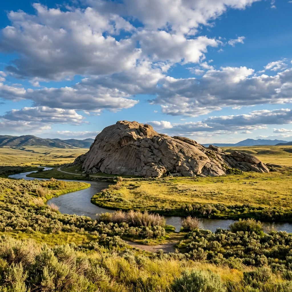
Rising from the sagebrush and grassland of central Wyoming like a beached whale turned to stone, Independence Rock is one of the most recognizable landmarks on the Oregon Trail. This massive granite dome — 1,900 feet long, 700 feet wide, and 128 feet tall — served for decades as a natural bulletin board for westward-bound emigrants who carved, painted, and scratched their names into its surface as proof of their passage across the continent.
Known as the “Register of the Desert”, Independence Rock bears the inscriptions of an estimated 5,000+ emigrants who passed this way between the 1840s and 1860s. Pioneers heading to Oregon, California, and Utah territories knew that reaching Independence Rock by the Fourth of July meant they were on schedule to cross the Rocky Mountains before winter snows closed the passes. Today, the rock stands as a State Historic Site in Natrona County, a tangible, touchable connection to one of the greatest mass migrations in human history.
Table of Contents
Oregon Trail History
Independence Rock’s significance lies in its geography. Positioned along the Sweetwater River corridor — the primary route through central Wyoming toward South Pass and the Continental Divide — the rock was an unavoidable landmark for every emigrant wagon train heading west. The name likely derives from a fur trader celebration on July 4th near the rock, and it became the standard by which pioneers judged their progress.
📜 Historical Timeline
• Pre-1800s: Native American peoples (Shoshone, Arapaho, Crow) use the area for hunting and travel
• 1812: First documented mention by Robert Stuart’s returning Astorians
• 1830: Named “Independence Rock” — likely after a July 4th celebration
• 1840s–1860s: Peak emigration era — 350,000+ pioneers pass the rock on the way to Oregon, California, and Utah
• 1847: Mormon pioneers led by Brigham Young pass Independence Rock en route to Salt Lake Valley
• 1860–1861: Pony Express riders pass within sight of the rock
• 1920: Designated a National Historic Landmark
• Present: Managed as a Wyoming State Historic Site
The Rock
Independence Rock is a granite batholith — an erosion-resistant dome of igneous rock exposed by millions of years of weathering. The rock is composed of Precambrian granite approximately 1.5 billion years old.
| Measurement | Detail |
|---|---|
| 📏 Length | 1,900 feet (approximately 0.36 miles) |
| 📐 Width | 700 feet |
| 📊 Height | 128 feet above surrounding terrain |
| 🪨 Rock Type | Precambrian granite (~1.5 billion years old) |
| 📍 Elevation | 5,900 feet above sea level |
| 🏛️ Designation | National Historic Landmark (1920), Wyoming State Historic Site |
Pioneer Inscriptions
The most compelling feature of Independence Rock is the thousands of names and inscriptions carved, painted, or scratched into its surface by Oregon Trail emigrants. Father Pierre-Jean De Smet, a Jesuit missionary who passed the rock in 1841, called it the “Register of the Desert” because of the sheer number of names already visible.
Many inscriptions have weathered away over 180+ years, but hundreds remain legible. Some pioneers used axle grease, tar, or paint to write their names. Others laboriously chiseled letters into the granite. A few hired professional stone carvers who accompanied wagon trains specifically for this purpose.
Important: The remaining inscriptions are protected historic resources. It is illegal and deeply disrespectful to add modern graffiti to the rock. Do not carve, paint, or scratch any markings on Independence Rock.
Hiking the Rock
Visitors can walk to the base of the rock and, in most conditions, scramble to the top. The ascent is not a maintained trail but rather a route up the granite slope — moderate in difficulty but requiring good footwear and caution on the smooth, sloping rock surface.
🥾 Climbing Tips
• Difficulty: Moderate scramble — no ropes needed, but not a casual walk
• Footwear: Rubber-soled shoes essential — slippery when wet
• Time: 30–45 minutes round trip to the summit
• Views from top: 360° panorama of the Sweetwater River valley, Wind River Range, and the vast Wyoming landscape
• Hazards: Loose gravel on granite, sudden weather (lightning), wind
• Best time: Morning (cooler, better photography light)
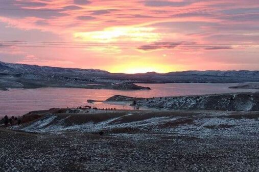
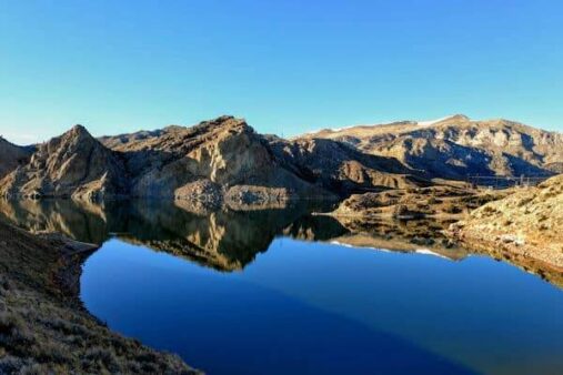
The Sweetwater River
Independence Rock sits on the north bank of the Sweetwater River, the gentle, constant companion of the Oregon Trail through central Wyoming. The emigrants followed the Sweetwater for 100+ miles through a landscape of sagebrush, granite outcrops, and wide-open sky, crossing the river multiple times before ascending to South Pass — the gentle crossing of the Continental Divide.
Visitor Information
| Detail | Information |
|---|---|
| 📍 Location | Highway 220, Natrona County, WY — 55 miles SW of Casper |
| 📞 Contact | Wyoming State Parks: (307) 577-5150 |
| 🕐 Hours | Year-round, dawn to dusk (unmanned site) |
| 💰 Entry Fee | Free |
| 🅿️ Parking | Small gravel lot with interpretive signs |
| 🚻 Restrooms | Vault toilets at parking area |
| ⛺ Camping | Primitive camping nearby (no developed campground) |
| 📡 Cell Service | Very limited — remote area |
Best Time to Visit
| Season | Weather | Best For |
|---|---|---|
| 🌸 Spring (May–Jun) | 50–70°F | Comfortable exploration, wildflowers on prairie |
| ☀️ Summer (Jul–Aug) | 75–90°F | Best access, long days, July 4th historical resonance |
| 🍂 Fall (Sep–Oct) | 40–65°F | Cool air, golden grass, fewer visitors |
| ❄️ Winter (Nov–Apr) | 10–35°F | Accessible but cold, possible snow, solitude |
Nearby Attractions
| Destination | Distance | Highlights |
|---|---|---|
| Devil’s Gate | 6 miles SW | Dramatic gorge cut through granite ridge by Sweetwater River |
| Martin’s Cove | 10 miles SW | Mormon handcart tragedy site (1856), visitor center |
| Split Rock | 30 miles SW | Another major Oregon Trail landmark visible for miles |
| Casper | 55 miles NE | National Historic Trails Center, supplies, lodging |
Frequently Asked Questions
Can you climb Independence Rock?
Yes — visitors can scramble to the summit of Independence Rock. It’s a moderate climb on granite slopes (no ropes needed) that takes about 30–45 minutes round trip. Wear rubber-soled shoes for traction. The top offers 360° views of the Sweetwater River valley and the distant Wind River Range.
Can you still see pioneer names on the rock?
Yes — hundreds of inscriptions remain legible after 180+ years. Some were carved into the granite, others painted with tar or axle grease. The best-preserved inscriptions are on the south and east faces. It is illegal to add modern markings — the inscriptions are protected historic resources.
Why is it called Independence Rock?
The name likely originated from a July 4th celebration held near the rock by fur traders around 1830. The name also took on practical significance: Oregon Trail emigrants knew that reaching Independence Rock by Independence Day (July 4th) meant they were on schedule to cross the Rockies before winter.
Is there an entrance fee?
No — Independence Rock State Historic Site is free to visit. The site is unmanned with a parking lot, vault toilets, and interpretive signs.
How far is Independence Rock from Casper?
Independence Rock is approximately 55 miles southwest of Casper, Wyoming, along Highway 220. The drive takes about one hour through open rangeland. Casper has the nearest hotels, restaurants, fuel, and supplies.
What is Devil’s Gate?
Devil’s Gate is a dramatic, narrow gorge just 6 miles southwest of Independence Rock where the Sweetwater River cuts through a granite ridge. The gorge is approximately 370 feet deep and only 50 feet wide. It was another major landmark on the Oregon Trail. The site also includes Martin’s Cove, associated with the tragic Mormon handcart rescue of 1856.
Is there camping?
There is no developed campground at Independence Rock. Primitive camping is possible in the surrounding BLM (Bureau of Land Management) land. For developed camping, Casper (55 miles) and Alcova Reservoir (20 miles north) offer campground options.
🏛️ Visit Independence Rock
Stand where 350,000 pioneers stood, read their 180-year-old inscriptions, climb the “Register of the Desert,” and trace the Oregon Trail through the heart of Wyoming.
🗺️ Wyoming State Historic Sites