🌤 Weather at Missouri Headwaters State Park by season
| Spring | Summer | Fall | Winter |
|---|---|---|---|
| 26–66 °F | 48–85 °F | 23–73 °F | 15–37 °F |
Each range runs from the coldest monthly average low to the warmest monthly average high in that season (1991-2020 climate normals), measured at Trident, 2 mi away, elevation 4,036 ft. Conditions at the park can differ from the station, especially where elevation differs — check a forecast before you go.

🏛️ Where America’s Greatest River Begins — The exact confluence where the Jefferson, Madison, and Gallatin Rivers form the Missouri, Lewis & Clark’s pivotal 1805 campsite, and a living classroom of western expansion history
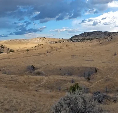
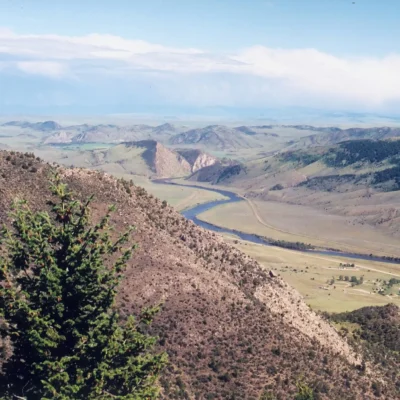
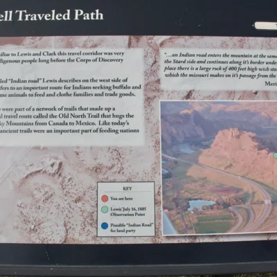
At a quiet bend in the Montana prairie where three mountain-born rivers converge into one, the Missouri River — the longest river in North America at 2,341 miles — begins its epic journey to the Mississippi. Missouri Headwaters State Park preserves this geographically and historically significant confluence, the precise spot where Meriwether Lewis wrote in his journal on July 25, 1805: “The country opens suddenly to extensive and butifull plains and meadows which appear to extend in every direction.” The park’s 532 acres encompass the meeting point of the Jefferson, Madison, and Gallatin Rivers — each named by Lewis and Clark for President Thomas Jefferson, Secretary of State James Madison, and Secretary of the Treasury Albert Gallatin.
This is more than a scenic park — it’s a crossroads of American history. For thousands of years, this fertile confluence was a meeting ground for the Shoshone, Blackfeet, Crow, and other indigenous peoples. It was here, five years before the expedition’s arrival, that a young Shoshone girl named Sacagawea was captured in a Hidatsa raid — the same woman who would later guide Lewis and Clark to this very spot. The park’s interpretive trails and displays tell this layered story of indigenous life, exploration, fur trade, and westward expansion against a backdrop of some of Montana’s most beautiful river valley scenery.
Things to Do
| Activity | Details | Best Season |
|---|---|---|
| Hiking & Walking | Several miles of flat to moderate trails along rivers and bluffs | April–October |
| Fishing | Rainbow trout, brown trout, mountain whitefish; blue-ribbon waters | Year-round (peak: June–September) |
| Kayaking / Canoeing | Paddle all three rivers; boat ramp available | May–September |
| Historical Tours | Self-guided interpretive trails with Lewis & Clark displays | Year-round |
| Wildlife Viewing | Deer, moose, beaver, river otter, eagles, osprey | Year-round |
| Photography | River confluence, mountain backdrops, wildflowers | May–September (golden hour) |
| Stargazing | Minimal light pollution; Bortle Class 2-3 skies | Year-round (best: summer) |
Hiking Trails
| Trail | Distance | Difficulty | Highlights |
|---|---|---|---|
| Fort Rock Trail | 1.5 mi RT | Easy-Moderate | Limestone bluff; panoramic views of all three rivers |
| Lewis & Clark Interpretive Trail | 2 mi loop | Easy | Historical markers, Sacagawea story, expedition campsite |
| River Walk Trail | 1.8 mi | Easy | Along Jefferson River; excellent birding and wildlife |
| Headwaters Trail | 3 mi loop | Easy-Moderate | Full confluence exploration; connects all major viewpoints |
Camping
| Site Type | Number | Hookups | Rate | Notes |
|---|---|---|---|---|
| Tent Sites | 17 | None | $18-28/night | Riverside locations; fire rings; picnic tables |
| RV Sites | 8 | None | $18-28/night | Can accommodate larger rigs; no hookups |
| Tipi Rental | 1 | None | $45-65/night | Unique experience; sleeps 4-6 |
| Group Camp | 1 | None | $75-100/night | Up to 24 people; reservable |
Amenities: Flush toilets, hot showers (seasonal), fire rings, picnic tables, campground host. Reserve online through Montana State Parks — summer weekends fill quickly.
Fishing
The Headwaters region offers some of Montana’s finest blue-ribbon trout fishing. All three rivers support healthy populations of rainbow trout, brown trout, and mountain whitefish. The Madison River, in particular, is considered one of the top fly-fishing rivers in the United States.
- Rainbow Trout: 12–18 inches typical; present in all three rivers
- Brown Trout: Best in the Jefferson and Madison; trophy fish to 24 inches
- Mountain Whitefish: Abundant; often overlooked but excellent fighters
- License: Montana state fishing license required; available online
- Techniques: Fly fishing most popular; nymphing and dry flies July–September
Best Time to Visit
| Season | Temp Range | Best For | Notes |
|---|---|---|---|
| 🌸 Spring (Apr–May) | 35–65°F | Wildflowers, birding, early fishing | Rivers may be high with snowmelt; muddy trails possible |
| ☀️ Summer (Jun–Aug) | 60–90°F | Camping, kayaking, fishing, stargazing | Peak season; best weather; mosquitoes near rivers |
| 🍂 Fall (Sep–Oct) | 35–65°F | Fall colors, hunting, solitude | Fewer crowds; excellent trout fishing; elk bugling nearby |
| ❄️ Winter (Nov–Mar) | 5–35°F | Eagle watching, snowshoeing, photography | Reduced services; beautiful stark landscapes |
Budget Planner
| Expense | Cost | Notes |
|---|---|---|
| Vehicle Permit (Non-Resident) | $8 | Required for park entry |
| Annual MT Parks Passport | $45 resident / $51 non-resident | Valid at all Montana state parks |
| Camping | $18-28/night | Primitive; no hookups |
| Tipi Rental | $45-65/night | Unique; reserve in advance |
| Fishing License (Non-Resident) | $25/2-day or $86/season | Required for all anglers 12+ |
| AIS Inspection | Free | Mandatory for all watercraft entering Montana |
Wildlife
| Species | Where to Spot | Best Season |
|---|---|---|
| Moose | Willow thickets along Jefferson River | Year-round (dawn/dusk) |
| White-tailed Deer | Throughout park, forest edges | Year-round |
| Beaver | River banks, look for lodges and dams | Year-round (dusk) |
| River Otter | All three rivers | Year-round |
| Bald Eagle | Soaring over rivers, perched in cottonwoods | Year-round (peak: winter) |
| Osprey | Nesting platforms near water | April–September |
| Great Blue Heron | Shallow river margins | Spring–Fall |
Safety Information
| Hazard | Precaution |
|---|---|
| Rattlesnakes | Present on rocky bluffs and grasslands; watch where you step and sit |
| River Currents | All three rivers can have strong, deceptive currents; wear a PFD when boating |
| Mosquitoes | Heavy near rivers June–August; bring repellent |
| Lightning | Open prairie is exposed; seek shelter immediately during storms |
| AIS Inspection | All watercraft must be inspected; non-compliance carries fines |
Frequently Asked Questions
Where exactly do the three rivers meet?
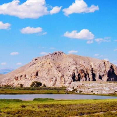
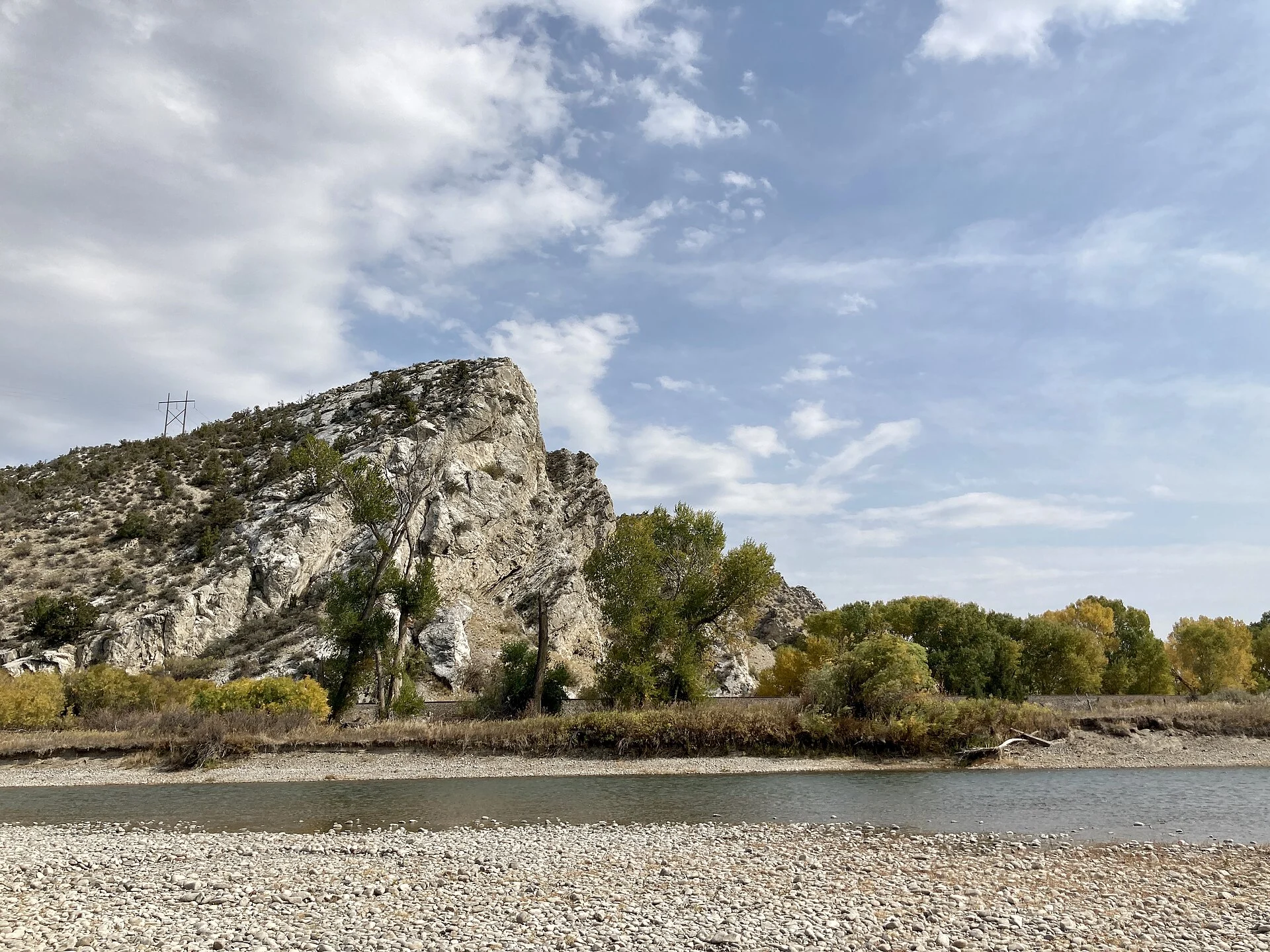
The Jefferson and Madison Rivers merge first, then the Gallatin joins approximately 1 mile downstream to officially form the Missouri River. Fort Rock, a prominent limestone bluff in the park, provides the best elevated viewpoint to see the confluence. The Headwaters Trail connects all the key viewpoints.
Is this where Lewis and Clark camped?
Yes — the Corps of Discovery camped near the headwaters from July 25-30, 1805. Lewis named the three rivers, and the expedition spent several days exploring and mapping the confluence before proceeding up the Jefferson River toward the Continental Divide. Interpretive signs mark the approximate campsite location.
Can I fish all three rivers from the park?
Yes — the park provides access to the Jefferson, Madison, and Gallatin Rivers. A Montana fishing license is required. The Madison is particularly renowned for fly fishing, with excellent hatches from June through September. There is a boat ramp for launching kayaks, canoes, and small boats.
How far is Yellowstone National Park?
The Yellowstone west entrance (West Yellowstone) is approximately 90 miles south — about a 1.5-hour drive. Many visitors combine a Missouri Headwaters visit with a Yellowstone trip, using Three Forks or Bozeman (30 miles east) as a base.
Is there hookup camping?
No — all camping at Missouri Headwaters is primitive (no electric, water, or sewer hookups). The park does have flush toilets and seasonal hot showers. The nearby city of Three Forks has private RV parks with full hookups. For a unique experience, rent the park’s tipi.
Is the park good for stargazing?
Excellent — the park is located in a rural area with minimal light pollution (Bortle Class 2-3). Summer nights offer spectacular Milky Way views from the open prairie areas. The absence of trees on the bluffs provides unobstructed horizons in all directions.
Explore More Montana State Parks
Missouri River Headwaters State Park is one of many outstanding state parks in Montana. Discover more parks in our Best State Parks in Montana guide, or use our Park Finder to search by activity, location, or features.
Make it a road trip: Pair a visit with Missouri Headwaters State Park (a short drive away) or Missouri Headwaters State Park (a short drive away).

🐾 Dogs & Pets at Missouri Headwaters State Park
- Pets allowed? statewide rule
- Pets are allowed at most Montana state parks but must be leashed and not left unattended.
- Leash rule statewide rule
- Leash no longer than 8 feet required, unless otherwise posted.
- Beaches & swim areas statewide rule
- Pets are prohibited from swimming beaches and posted restricted areas.
- Statewide exceptions statewide rule
- Pets prohibited at Frenchtown Pond and Wild Horse Island; kennel service offered during Lewis and Clark Caverns tours; Spring Meadow Lake no pets April 16 - October 14; Lake Elmo has a fenced dog park.
Are dogs allowed at Missouri Headwaters State Park?
Pets are allowed at most Montana state parks but must be leashed and not left unattended. Individual parks can post stricter rules — check signage on arrival.
Rules verified July 2026 via fwp.mt.gov. More: Montana state parks guide · Dog rules in all 50 states compared
Park Location
Plan your gear for Missouri Headwaters State Park
From our editorial guides, matched to this park’s activities: