🏆🏆🏆🏆🏆 Connecticut Valley Overlook — Volcanic summit overlooking the Pioneer Valley — one of the most photographed views in New England
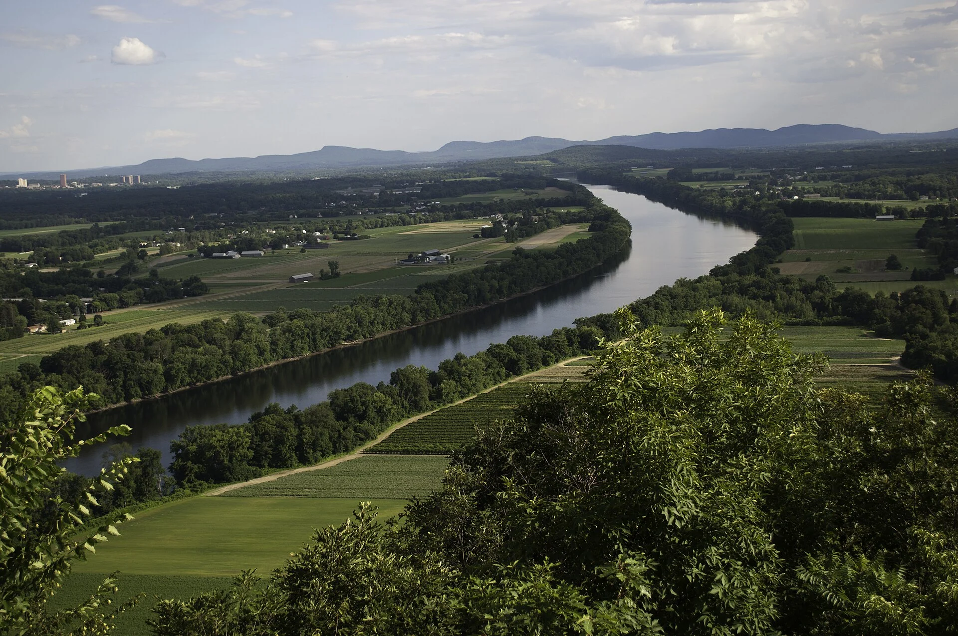
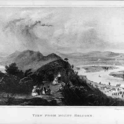
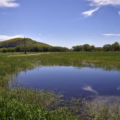
Mount Sugarloaf State Reservation preserves the dramatic volcanic summit of South Sugarloaf Mountain (652 feet) overlooking the Connecticut River’s Pioneer Valley. The summit provides one of the most photographed views in New England — the Connecticut River snaking through a patchwork of farm fields and forests below, with the Pelham Hills and Mount Holyoke Range in the distance. The mountain is composed of Jurassic-era arkose sandstone and conglomerate, formed 200 million years ago.
Visitor Information
| Detail | Information |
|---|---|
| Location | Deerfield, Franklin County, MA |
| Elevation | 652 feet (auto road to summit!) |
| Entry Fee | Parking fee ($5 MA / $20 out-of-state) |
| View | TOP-PHOTOGRAPHED CT River valley! |
Frequently Asked Questions
Can I drive to the top?
Yes! A paved auto road reaches the summit of South Sugarloaf. You can also hike from the base (approximately 1 mile, moderate). The summit observation platform has benches and interpretive signs.
There are dinosaur tracks in Massachusetts?
Yes — the Connecticut River Valley contains thousands of Jurassic-era dinosaur tracks (190+ million years old). The tracks were first identified by Amherst College professor Edward Hitchcock in the 1830s — among the first dinosaur fossils recognized in North America. The Beneski Museum at Amherst College has the world’s largest collection of dinosaur tracks.
More parks nearby: Norwottuck Rail Trail is a short drive away, while Lake Wyola State Park lies a short drive away.
About Mount Sugarloaf
Mount Sugarloaf State Reservation in South Deerfield features a dramatic 652-foot sandstone peak rising above the Connecticut River valley — offering one of the most famous views in New England. The summit overlooks the oxbow of the Connecticut River (made famous by Thomas Cole’s 1836 painting “The Oxbow”). The Pocumtuck people considered this mountain sacred.
Things to Do
Driving or hiking to the summit observation tower, viewing the iconic Connecticut River oxbow, picnicking at the summit pavilion, and connecting to the adjacent trail network. The valley views are breathtaking during fall foliage. An auto road reaches the summit.
Insider Tips
Connecticut Valley views: Mount Sugarloaf (652 ft) overlooks the Connecticut River Valley in Deerfield — one of the most fertile and historically significant valleys in New England. Pro tip: The observation tower provides views of the “Great Oxbow” — the horseshoe bend in the Connecticut River made famous by Thomas Cole’s 1836 painting. Dinosaur tracks: The Connecticut Valley is one of the world’s richest sites for Jurassic-era dinosaur tracks.
Best Time to Visit
Fall: Valley foliage from the summit. Summer: Quick drive or hike to views. Spring: Flooding reveals the river’s power. Winter: Clear valley views.
Wildlife & Nature
Mount Sugarloaf SR — 532 ft — a red sandstone ridge above the Connecticut River with spectacular views of the Pioneer Valley and the Connecticut River oxbow. The ridge’s sandstone, mixed forest, and cliff edge support red-tailed hawks, turkey vultures, and peregrine falcons. Thomas Cole’s painting “The Oxbow” (1836) — one of the most famous American landscape paintings — depicted this view.
Nearby Attractions
Deerfield — adjacent — site of the 1704 Deerfield Raid. Historic Deerfield — a museum village. Amherst — 10 miles south.

Park Location


Top Tours & Activities Near Massachusetts
 from $550
 from $45
 from $70