
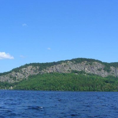
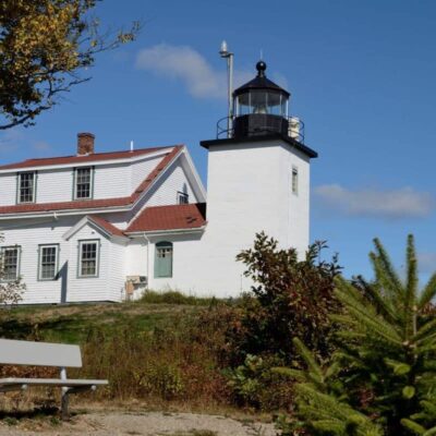
Photo: USGS, public domain, via Wikimedia Commons
🌤 Weather at Nahmakanta by season
| Spring | Summer | Fall | Winter |
|---|---|---|---|
| 16–64 °F | 51–78 °F | 27–70 °F | 5–31 °F |
Each range runs from the coldest monthly average low to the warmest monthly average high in that season (1991-2020 climate normals), measured at Millinocket, 18 mi away, elevation 360 ft. Conditions at the park can differ from the station, especially where elevation differs — check a forecast before you go.

🏆 100-Mile Wilderness AT — 43,000-acre wilderness unit on the Appalachian Trail’s legendary 100-Mile Wilderness
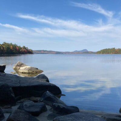
Nahmakanta Public Reserved Land covers 43,000 acres in the heart of the Appalachian Trail’s legendary 100-Mile Wilderness — the final (or first) section of the 2,190-mile trail, with no roads, towns, or services. Nahmakanta Lake is a pristine mountain lake where the AT passes along the shore. The 100-Mile Wilderness is considered the wildest, most remote section of the entire Appalachian Trail — thru-hikers must carry 7–10 days of food to traverse it. “Nahmakanta” is Abenaki for “lake of the largest fish.”
Visitor Information
| Detail | Information |
|---|---|
| Location | T1R11 WELS, Piscataquis, ME |
| Size | 43,000 acres! |
| Entry Fee | Free |
| Trail | 100-MILE WILDERNESS — AT’s wildest! |
| Name | Abenaki: “lake of the largest fish” |
Frequently Asked Questions
What is the 100-Mile Wilderness?
The 100-Mile Wilderness stretches from Abol Bridge to Monson — the longest section of the AT without road crossings. Thru-hikers carry a week or more of food. Despite the name, it’s closer to 95 miles — but feels like 200.
What is the 100-Mile Wilderness?
The 100-Mile Wilderness stretches from Monson to Baxter State Park — the Appalachian Trail’s most remote section. No paved roads, no towns, no cell service. Hikers must be completely self-sufficient. The terrain includes mountains, bogs, lake shores, and dense spruce forest. For northbound thru-hikers, it’s the final challenge before summiting Katahdin — the AT’s northern terminus and emotional climax.
Make it a road trip: Pair a visit with Baxter State Park (within about an hour’s drive) or Wassataquoik (within about an hour’s drive).
About Nahmakanta
Nahmakanta public reserved land covers over 43,000 acres of wilderness around Nahmakanta Lake — the largest state-owned unit of public reserved land in Maine. The Appalachian Trail traverses the property, and the lake is one of the most pristine in the state. The area provides a true wilderness experience comparable to northern Canada, yet accessible from Millinocket.
Things to Do
Hiking the Appalachian Trail, canoeing Nahmakanta Lake and the connecting waterways, fishing for brook trout and salmon, primitive camping, moose watching, and experiencing one of the largest roadless areas in the eastern United States.
Insider Tips
AT wilderness: Nahmakanta sits along the Appalachian Trail’s final stretch — the “100-Mile Wilderness” before Katahdin. Pro tip: The 100-Mile Wilderness is the AT’s longest stretch without road crossings — hikers must carry 7-10 days of food. Thru-hikers: By the time northbound thru-hikers reach Nahmakanta, they’ve walked 2,100+ miles from Georgia — Katahdin is tantalizingly close.
Best Time to Visit
September: Thru-hikers arriving at Katahdin. Summer: Canoeing and fishing. Fall: Remote wilderness foliage. Winter: Snowmobile access only.
Wildlife & Nature
Nahmakanta — 43,000 acres of pristine wilderness in the 100-Mile Wilderness — the most remote section of the Appalachian Trail. Nahmakanta Lake is considered one of the purest lakes in Maine. The area’s boreal forest, remote ponds, and streams support moose, loons, Canada lynx, and brook trout.
Nearby Attractions
100-Mile Wilderness — through the area. Baxter SP / Mount Katahdin — 30 miles north. Millinocket — 40 miles northeast.

🐾 Dogs & Pets at Nahmakanta
Park policy: Maine's rules for Public Lands (01-670 C.M.R. ch. 51, § 1.5) require pets in campsites to be kept leashed and not left unattended; outside campsites, pets must be kept under control (rule text at law.cornell.edu, checked November 2026).
- Pets allowed?
- Yes, pets must be leashed and attended at campsites and kept under control elsewhere on these Maine Public Lands
- Dogs & wildlife
- Trappers are permitted on Maine public lands, so the Bureau of Parks and Lands advises pet owners to exercise caution (Nahmakanta page, apps.web.maine.gov, checked November 2026).
Are dogs allowed at Nahmakanta?
Yes, pets must be leashed and attended at campsites and kept under control elsewhere on these Maine Public Lands.
More: Maine state parks guide · Dog rules in all 50 states compared
Park Map
Plan your gear for Nahmakanta
From our editorial guides, matched to this park’s activities:

Top Tours & Activities around Bangor (about 65 mi away)
 from $20
 from $8
 from $201