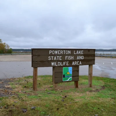
🦆 Where Coal Mines Became Wetlands — 4,300 Acres of Reclaimed Illinois Marshland — Banner Marsh State Fish and Wildlife Area in Fulton and Peoria Counties, Illinois, 4,300 acres of reclaimed strip-mine land converted to wetlands and lakes, fishing for largemouth bass crappie bluegill and catfish, waterfowl hunting, 66 ponds and lakes, upland game hunting, birding, Illinois River Road scenic byway — Fulton/Peoria Counties, IL
For decades, coal companies stripped the earth from central Illinois. They dug trenches, pulled out the coal, and left behind moonscapes of spoil piles and acid water. When the mining stopped, nature — with help from the Illinois Department of Natural Resources — began to take it back.
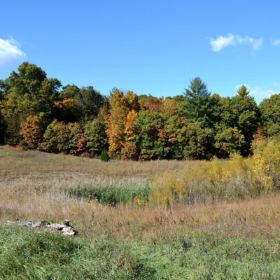
Today, Banner Marsh is 4,300 acres of wetland, grassland, and 66 man-made lakes and ponds that occupy the excavated land. Largemouth bass grow fat in the strip pits. Waterfowl flood the marshes during migration. Deer browse the grasslands. It’s one of the most successful mine-to-wildlife conversions in the Midwest.
What to Do
| Activity | Details |
|---|---|
| Fishing | 66 ponds and lakes — largemouth bass, crappie, bluegill, channel catfish, and bullhead. Many ponds are walk-in only. Bank fishing and small boat (electric motors). Some of the best panfish waters in central Illinois |
| Waterfowl Hunting | Managed waterfowl hunting areas during fall migration. Canada geese, mallards, teal, and wood ducks. Blind assignments by lottery. Check IDNR regulations |
| Upland Hunting | Pheasant, quail, rabbit, and dove hunting in season. The grasslands and field borders provide excellent upland habitat |
| Deer Hunting | Archery and firearm deer seasons. The mix of grassland, timber, and water creates productive deer habitat |
| Birding | Year-round birding — waterfowl in migration, shorebirds on mud flats, grassland sparrows, and raptors. The wetlands attract species not found in surrounding farmland |
| Hiking | Walking paths and service roads through the property. No formal trail system, but the terrain is open and walkable. Bring binoculars |
From Mine to Marsh
| Era | What Happened |
|---|---|
| 1920s–1960s | Coal companies strip-mine thousands of acres of central Illinois farmland. The overburden is piled in long ridges. Deep trenches fill with water — creating the strip pits that become today’s fishing ponds |
| 1960s–1980s | Mining declines. The Illinois Department of Natural Resources acquires the land. Reclamation begins — spoil piles are graded, grasslands are planted, and wetlands are engineered |
| 1980s–Present | Banner Marsh becomes a functioning wildlife area. The 66 ponds establish fish populations. Grasslands mature. Waterfowl discover the wetlands. A damaged landscape becomes one of central Illinois’ most productive wildlife habitats |
Best Time to Visit
| Season | Best For |
|---|---|
| Spring (Apr–May) | 🌸 Bass spawning in the ponds. Migrating waterfowl and shorebirds. Wildflowers on the grasslands. Turkey season |
| Fall (Sep–Nov) | 🍂 Peak waterfowl migration. Deer season opens. Crappie and catfish active. Grasslands golden |
| Summer (Jun–Aug) | Fishing best at dawn and dusk. Bluegill and catfish productive. Hot on open grasslands. Birding steady |
| Winter (Dec–Feb) | Late waterfowl hunting. Ice fishing when ponds freeze (check thickness). Quiet and cold. Eagle watching |
Frequently Asked Questions
Can I use a boat?
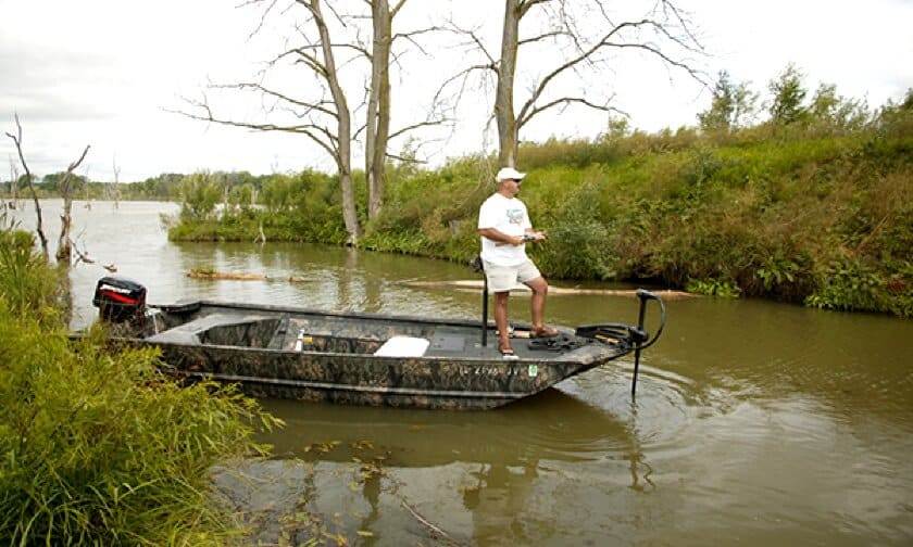
Electric motors only on most ponds. No gasoline motors. Small boats, canoes, and kayaks work well. Many of the 66 ponds are walk-in only — bring lightweight gear.
Is there a trail system?
No formal trails — but the area is open and walkable. Service roads, levees, and mowed paths provide access throughout the 4,300 acres. Wear boots — the terrain can be wet and uneven, especially near the marsh areas.
How did strip mines become wetlands?
The mining itself created the ponds. When coal companies removed the overburden (the soil and rock above the coal), they left deep trenches that filled with water. The Illinois DNR then graded the spoil piles, planted native grasses, and engineered additional wetlands. Nature did the rest — fish populations established, waterfowl found the habitat, and the ecosystem recovered.
Keep exploring: The closest neighbors are Banner Marsh (Illinois) (a short drive away) and Devils Island Wildlife Management Area (a short drive away).
🦆 They Dug for Coal. Nature Filled It with Water and Life.
66 ponds in the holes where coal used to be. 4,300 acres of grassland on the spoil piles. Bass in the strip pits. Ducks on the marshes. Illinois’s best mine-to-wildlife story.