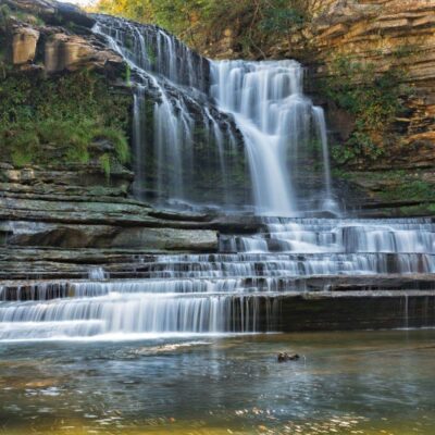
🏆🏆🏆 80-Foot Cascading Falls — Spectacular multi-tier waterfall on the Cumberland Plateau
Stinging Fork Falls State Natural Area in Overton County features an 80-foot multi-tier waterfall where Stinging Fork Creek drops over sandstone ledges in a series of cascades. The falls are set in a hemlock and hardwood gorge on the Cumberland Plateau, with the descending trail providing dramatic views of each tier. The creek’s name reportedly comes from the stinging nettles that grow along its banks.
Visitor Information
| Detail | Information |
|---|---|
| Location | Overton County, TN (Cumberland Plateau) |
| Entry Fee | Free |
| Falls | 80 feet, multi-tier cascade |
| Trail | Steep descent to falls |
Frequently Asked Questions
Is the trail difficult?
The trail descends steeply to the falls. Good footwear is essential as rocks can be slippery. The descent is moderate but the return climb is strenuous. Allow extra time for the uphill return.
Why does the Cumberland Plateau have so many waterfalls?
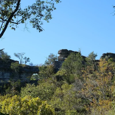
The Cumberland Plateau is a flat-topped sandstone tableland — when creeks reach the plateau edge, they plunge over vertical cliffs. This geological setup creates hundreds of waterfalls in a relatively small area. Tennessee’s plateau has more waterfalls than most states in their entirety. Many remain remote and unnamed — true wilderness discoveries.
More parks nearby: Washmorgan Hollow State Natural Area is a short drive away, while Window Cliffs State Natural Area lies within about an hour’s drive.
🌊 Visit Stinging Fork Falls SNA
80-foot multi-tier cascade — dramatic Cumberland Plateau waterfall in a hemlock gorge.
About Stinging Fork Falls
Stinging Fork Falls State Natural Area in Overton County protects a series of waterfalls along Stinging Fork Creek on the Cumberland Plateau. The main falls drops over sandstone ledges into a deep pool. The “stinging” in the name likely references stinging nettles that grow along the creek. The Cumberland Plateau of Tennessee has more waterfalls than any comparable region in the eastern U.S.
Things to Do
Hiking to the waterfalls, swimming in the pools below the falls (summer), waterfall photography, birdwatching, and exploring the Cumberland Plateau’s remarkable waterfall-rich landscape.
Insider Tips
Remote waterfall: Stinging Fork Falls drops 30+ feet into a deep swimming hole in a remote Cumberland Plateau gorge — one of Tennessee’s best-kept swimming secrets. Pro tip: The trail to the falls crosses the creek multiple times — expect wet feet. Plateau waterfalls: The Cumberland Plateau has more waterfalls per square mile than almost anywhere in the eastern US — the flat plateau rim creates hundreds of plunge waterfalls where creeks drop over the edge.
Best Time to Visit
Summer: Swimming hole at its best — warm enough to enjoy. Spring: Peak waterfall flow. Fall: Gorge foliage and comfortable swimming. Winter: Ice formations but too cold for swimming.
Wildlife & Nature
Stinging Fork Falls SNA — on the Cumberland Plateau — features a striking waterfall that drops into a natural pool surrounded by sandstone cliffs. Timber rattlesnakes and woodland salamanders inhabit the gorge. Barred owls call from the hemlocks.
Nearby Attractions
Crossville — nearby. Obed WSR — nearby. Cumberland Mountain SP — 10 miles south.