Connecticut’s Undeveloped Hilltop Wilderness — 200-Acre Forest Preserve, Bush Hill Summit, Informal Hiking, Bowhunting & Solitude in Lebanon-Windham
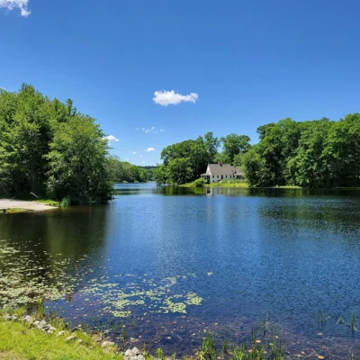
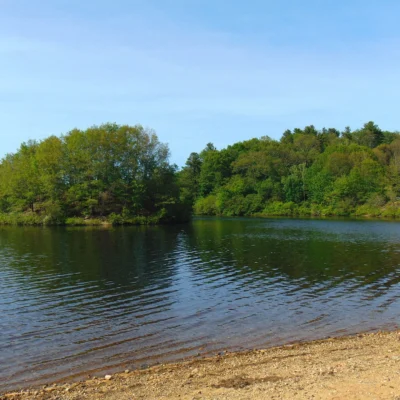
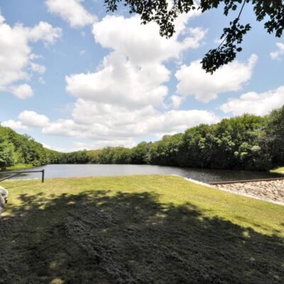
Pomeroy State Park is a 200-acre undeveloped state park in the towns of Lebanon and Windham, Connecticut, south of Willimantic. The park features undeveloped forest with no formal trails or amenities, access to Bush Hill summit, informal hiking through mixed hardwood forest, designated bowhunting area for deer and turkey (fall season), and complete solitude in one of Connecticut’s most overlooked state properties.
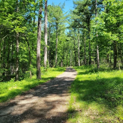
Pomeroy State Park is one of Connecticut’s least-known state parks — a 200-acre forested property with no signs, no formal trails, no maintained entrance, and no visitor facilities. Located south of Willimantic along Route 289 (Beaumont Highway), the park is primarily a forest preserve used by local hikers who navigate informal paths to the top of Bush Hill. During the fall season, the park serves as a popular bowhunting area for white-tailed deer and wild turkey. Small roadside pull-offs along Route 289 and Gates Road provide the only parking. This is a park for those seeking genuine solitude and unmanaged wilderness — not a destination with trailheads or visitor services.
Things to Do
Informal Hiking
- Bush Hill summit: Accessible via informal trails
- Mixed hardwood forest
- No maintained or blazed trails
- Navigational skills recommended
Bowhunting
- White-tailed deer: Fall archery season
- Wild turkey: Fall archery season
- Connecticut hunting license required
- Check CT DEEP regulations for seasons and rules
Nature Observation
- Undisturbed forest habitat
- Songbirds, woodpeckers, raptors
- Wildflowers in spring understory
- Complete solitude
Park Information
| Feature | Details |
|---|---|
| Acreage | 200 acres |
| Type | Undeveloped forest preserve |
| Location | Lebanon and Windham, CT — south of Willimantic |
| Access | Route 289 (Beaumont Highway) and Gates Road |
| Trails | Informal only — no maintained or blazed trails |
| Facilities | NONE — no restrooms, water, signs, or entrance |
| Parking | Small roadside pull-offs along Route 289 and Gates Rd |
| Camping | Not permitted |
| Hunting | Bowhunting — deer and turkey (fall season) |
| Coordinates | 41.6992° N, 72.2242° W |
Best Time to Visit
| Season | Highlights | Considerations |
|---|---|---|
| Fall (Sep–Nov) | ⭐ BEST: Fall foliage; cool hiking; bowhunting season; crisp air; mushrooms | Hunters present — wear blaze orange; shorter days; ticks |
| Spring (Apr–May) | Wildflowers; songbird migration; green-up; solitude; fern unfurling | Muddy; ticks very active; no trail markers; wet ground |
| Summer (Jun–Aug) | Full canopy; shade hiking; butterfly habitat; long days | Humid; mosquitoes; dense understory; poison ivy |
| Winter (Dec–Mar) | Snow tracking; bare-tree views; complete solitude; winter birds | Cold; no trails to follow in snow; icy; very short days |
Visitor Tips
- No signs or entrance: There is NO formal entrance, signage, or trailhead. Look for small roadside pull-offs along Route 289 (Beaumont Highway) and Gates Road.
- Navigation: Bring a GPS device or detailed topo map — there are no blazed trails.
- Hunting season: During fall, the park is used for bowhunting. Wear blaze orange if visiting during hunting season.
- Observe posted signs: Some boundaries adjoin private land — respect all posted signs.
- Ticks: Tick prevention is essential year-round in Connecticut — treat clothing and check after hiking.
- Nearby: Hop River State Park Trail and Air Line State Park Trail are nearby for paved trail hiking and biking.
Frequently Asked Questions
Wildlife & Nature
Pomeroy SP — along the scenic Housatonic River. The park’s river, hardwood forest, and meadows support bald eagles, ospreys, and white-tailed deer.
Nearby Attractions
Cornwall Bridge — adjacent. Litchfield County — surrounding. Housatonic River — at the park.
Where is Pomeroy State Park in Connecticut?
Pomeroy State Park is a 200-acre undeveloped forest preserve in the towns of Lebanon and Windham, Connecticut, south of Willimantic. It is located along Route 289 (Beaumont Highway) with small roadside parking pull-offs. There are no signs, formal trails, restrooms, or visitor facilities. The park is primarily used for informal hiking to Bush Hill summit and fall bowhunting for deer and turkey. A GPS device or topo map is recommended for navigation. Observe all posted signs as the park borders private land.
Last updated: May 2026
Nearby state parks: If you have extra time, Mono Pond State Park Reserve is a short drive away, and Mansfield Hollow State Park is a short drive away.