
Connecticut’s Hidden Trail Network — 5.4 Miles of Hiking, John Muir Trail Terminus, Testone Boulder Loop, Fishing, Snowshoeing & Free Walk-In Recreation Near Torrington
Sunnybrook State Park is a state park in Torrington, Litchfield County, Connecticut. The park features 5.4 miles of hiking trails including the Testone Boulder Loop, the Fadoir Spring Trail, and the Flyer Pond Trail, serves as the southwestern terminus of the blue-blazed John Muir Trail connecting to Paugnut State Forest and Burr Pond State Park, fishing access, snowshoeing in winter, and free admission.
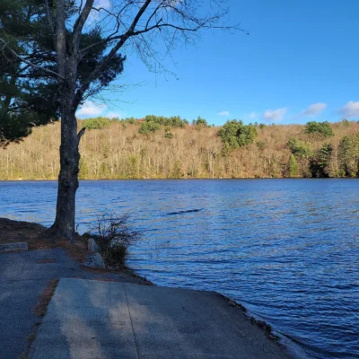
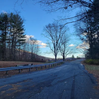
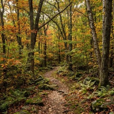
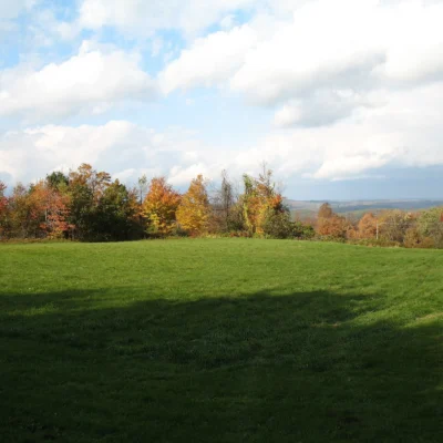
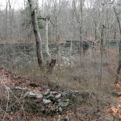
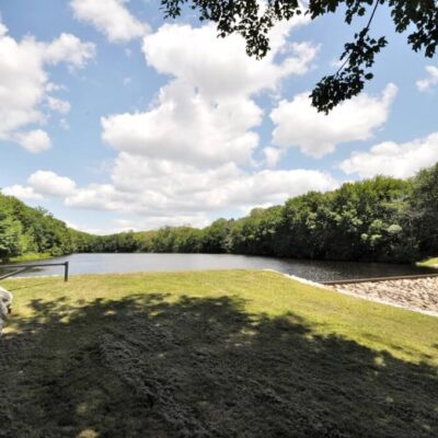
Sunnybrook State Park is a walk-in, undeveloped state park that conceals one of Connecticut’s most rewarding trail networks. The park offers approximately 5.4 miles of interconnected trails through mixed hardwood forest, wetlands, and rocky terrain. The standout feature is its role as the southwestern terminus of the blue-blazed John Muir Trail — a long-distance trail that connects through Paugnut State Forest to Burr Pond State Park. Named trails include the Testone Boulder Loop (featuring a massive glacial erratic), the Fadoir Spring Trail, and the Flyer Pond Trail. Despite being minimally developed, the park provides a varied and engaging hiking experience with packed earth, grass, and wetland crossings. Admission is free and the park is open sunrise to sunset.
Things to Do
Hiking
- Testone Boulder Loop: Moderate loop featuring a massive glacial erratic boulder
- Fadoir Spring Trail: Forest trail to natural spring area
- Flyer Pond Trail: Trail to scenic pond
- John Muir Trail terminus: Blue-blazed long-distance trail to Burr Pond SP
- ~5.4 miles total trail network
Trail Running
- Packed earth and grass surfaces
- Varied terrain — moderate difficulty
- Mixed forest shade
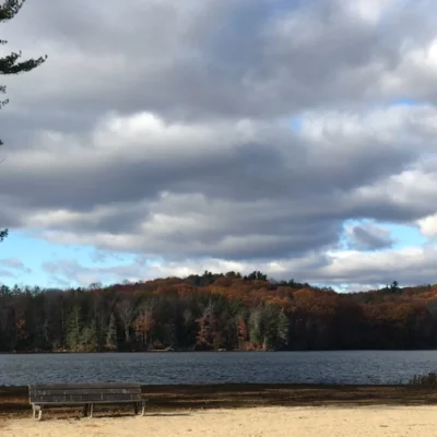
Fishing
- Pond fishing
- Connecticut fishing license required
Winter Activities
- Snowshoeing on trails
- Winter hiking
Park Information
| Feature | Details |
|---|---|
| Location | Torrington, Litchfield County, CT |
| Trails | ~5.4 miles — Testone Boulder Loop, Fadoir Spring, Flyer Pond |
| John Muir Trail | Southwestern terminus — connects to Burr Pond SP |
| Terrain | Packed earth, grass, wetlands, rocky sections |
| Fishing | Pond access — CT license required |
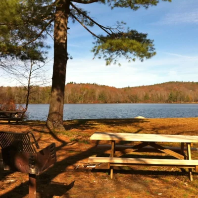
| Facilities | Minimal — picnicking areas only |
| Restrooms | Limited |
| Admission | FREE |
| Hours | Sunrise to sunset |
| Camping | NOT available |
| Hunting | Designated areas — check CT DEEP |
| Coordinates | 41.8358° N, 73.1203° W |
Best Time to Visit
| Season | Highlights | Considerations |
|---|---|---|
| Fall (Sep–Nov) | ⭐ BEST: Litchfield County foliage on trails; cool hiking; photography; crisp air; mushrooms | Hunting in designated areas — blaze orange; wet leaves; shorter days |
| Spring (Apr–May) | Wildflowers; spring migration birding; green-up; fresh streams; ferns | Muddy trails; ticks; wet wetland crossings |
| Summer (Jun–Aug) | Full canopy shade; trail running; pond fishing; long days; butterfly habitat | Humid; mosquitoes near wetlands; dense understory |
| Winter (Dec–Mar) | Snowshoeing; winter tracking; bare-tree views; solitude; ice formations | Cold; limited visibility for trail markers; icy sections |
Visitor Tips
- John Muir Trail: The park serves as the southwestern terminus of Connecticut’s blue-blazed John Muir Trail — follow the blazes northeast through Paugnut State Forest to Burr Pond State Park for a longer excursion.
- Testone Boulder: The Testone Boulder Loop is the park’s signature trail — the massive glacial erratic is a highlight for geology enthusiasts.
- Free admission: The park is free to visit — sunrise to sunset year-round.
- Undeveloped: The park is largely undeveloped — bring water, snacks, and tick prevention.
- Trail conditions: Wetland crossings can be muddy in spring — waterproof boots recommended.
- Nearby: Burr Pond State Park (swimming, boating) and John A. Minetto State Park (picnicking) are excellent complements nearby.
Frequently Asked Questions
Wildlife & Nature
Sunnybrook SP — in Torrington. The park’s brook, hardwood forest, and meadows support white-tailed deer, songbirds, and brook trout.
Nearby Attractions
Torrington — adjacent. Litchfield County — surrounding.
What trails are at Sunnybrook State Park in Connecticut?
Sunnybrook State Park in Torrington, Litchfield County, Connecticut, offers approximately 5.4 miles of hiking trails including the Testone Boulder Loop (featuring a massive glacial erratic), the Fadoir Spring Trail, and the Flyer Pond Trail. The park also serves as the southwestern terminus of the blue-blazed John Muir Trail, which connects through Paugnut State Forest to Burr Pond State Park. Trails wind through mixed hardwood forest with packed earth, grass, and wetland terrain. Admission is free and the park is open sunrise to sunset. Facilities are minimal — bring your own water and supplies.
Last updated: May 2026
More parks nearby: Stillwater Pond State Park is a short drive away, while Roraback Wildlife Management Area lies a short drive away.

Park Location
Top Tours & Activities Near Connecticut
 from $100
 from $28from $75