🌤 Weather at Banks�Vernonia State Trail by season
| Spring | Summer | Fall | Winter |
|---|---|---|---|
| 36–68 °F | 50–82 °F | 36–76 °F | 33–49 °F |
Each range runs from the coldest monthly average low to the warmest monthly average high in that season (1991-2020 climate normals), measured at Forest Grove, 9 mi away, elevation 180 ft. Conditions at the park can differ from the station, especially where elevation differs — check a forecast before you go.
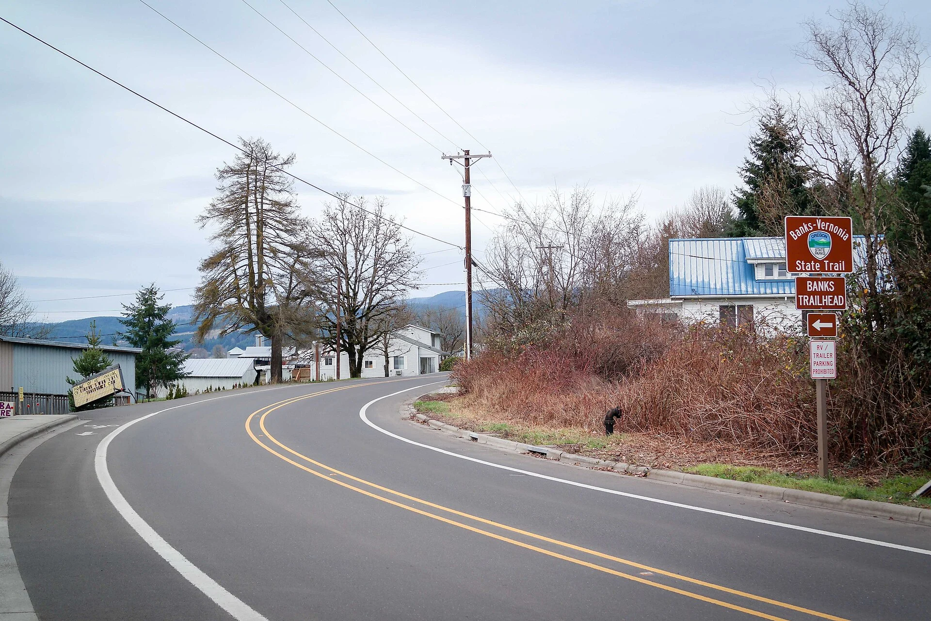
🚴 Oregon’s First Linear State Park — 21 Miles on a Logging Railroad Through the Coast Range — Banks-Vernonia State Trail in Columbia and Washington Counties, Oregon, 21-mile paved rail-trail on the old Spokane Portland and Seattle Railway logging corridor, Oregon’s first linear state park, historic wooden trestles including 700-foot Buxton Trestle, through Tillamook State Forest, hiking biking horseback riding, 800-foot elevation change — Columbia/Washington Counties, OR
For decades, trains hauled old-growth timber out of the Oregon Coast Range on the Spokane, Portland, and Seattle Railway. When the logging stopped, the tracks were pulled. Oregon turned the corridor into the state’s first linear park — 21 miles of paved trail from Banks to Vernonia, climbing through second-growth forest, crossing historic wooden trestles, and passing through the heart of the Tillamook State Forest.
This is not a flat suburban path. The trail gains and loses 800 feet of elevation as it crosses the Coast Range foothills. Historic trestles — including the spectacular 700-foot Buxton Trestle — carry the trail high above creek canyons. It’s rail-trail riding at its most dramatic.
Trail Details
| Feature | Details |
|---|---|
| Length | 21 miles one-way (42 miles round trip). Banks to Vernonia or reverse. Arrange a shuttle or ride out-and-back |
| Surface | Paved (asphalt) for the entire length. Suitable for road bikes, hybrids, strollers, and wheelchairs on sections |
| Elevation | Banks at ~200 feet, high point at ~1,000 feet, Vernonia at ~660 feet. Rolling with sustained climbs and descents. Not flat |
| Trestles | Multiple historic wooden railroad trestles. The Buxton Trestle (700 feet long, 80 feet high) is the showpiece — a restored logging railroad bridge spanning a forested canyon |
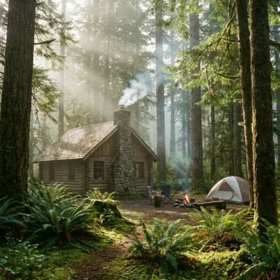
| Forest | Through Tillamook State Forest — second-growth Douglas fir and western hemlock that regrew after the Tillamook Burns (1933–1951). A forest of recovery |
| Uses | Hiking, biking, horseback riding (equestrian path on some sections). No motorized vehicles |
The History
| Year | Event |
|---|---|
| Early 1900s | The Spokane, Portland and Seattle Railway builds a logging railroad through the Coast Range to haul timber to Portland-area mills |
| 1933–1951 | The Tillamook Burns — a series of catastrophic forest fires destroy 350,000 acres of old-growth timber. The forest surrounding the railroad corridor is devastated |
| 1957–1973 | Oregon’s greatest reforestation effort replants the burned forest. Millions of Douglas fir seedlings. The forest you see today is the result |
| 1973 | The railroad ceases operations. The corridor is abandoned |
| 1990 | Oregon State Parks acquires the corridor and begins converting it to a trail — Oregon’s first linear state park |
Best Time to Visit
| Season | Best For |
|---|---|
| Summer (Jun–Sep) | ☀️ Dry weather. Long days. Coast Range at its best. Wildflowers along the trail. Peak cycling season |
| Fall (Oct–Nov) | 🍂 Big-leaf maple turning gold. Cool riding weather. Fewer cyclists. Morning fog in the valleys |
| Spring (Mar–May) | Trillium and wildflowers. Wet — Oregon spring rain. Muddy on equestrian sections. Beautiful when dry |
| Winter (Dec–Feb) | Wet and cold. Trail is open but rain is constant. Atmospheric fog-shrouded forest. Bring rain gear |
Frequently Asked Questions
Is the trail really 21 miles?
Yes — 21 miles one-way from Banks to Vernonia. Most cyclists ride it as a one-way trip with a shuttle. Strong riders do the 42-mile round trip. The 800-foot elevation change makes it a genuine workout in either direction.
What happened in the Tillamook Burns?
Four fires between 1933 and 1951 destroyed 350,000 acres of old-growth forest. It was one of the worst forest fire disasters in American history. Oregon responded with the largest reforestation effort ever attempted — millions of seedlings planted by hand. The forest you ride through today is that effort’s legacy.
Can I ride a road bike?
Yes — the entire trail is paved asphalt. Road bikes, hybrids, and mountain bikes all work. The pavement is generally well-maintained. Some sections have leaves and debris in fall and winter.
Nearby state parks: If you have extra time, L.L. Stub Stewart State Park is a short drive away, and Bald Peak State Scenic Viewpoint is within about an hour’s drive.
🚴 21 Miles on Rails That Once Hauled Giants
The old-growth is gone. The trains are gone. But the railroad bed remains — paved through a reborn forest, crossing trestles 80 feet above canyon floors. Oregon’s first linear park.
Wildlife & Nature
Banks–Vernonia ST — a 21-mile paved rail-trail — Oregon’s first linear state park. The trail’s temperate rainforest, creek crossings, and old railroad trestles support Roosevelt elk, black bears, and pileated woodpeckers. 13 railroad trestles — some up to 80 feet high — are highlights.
Nearby Attractions
Banks — southern trailhead. Vernonia — northern trailhead. Tillamook State Forest — surrounding.

🐾 Dogs & Pets at Banks�Vernonia State Trail
- Pets allowed? statewide rule
- Pets are welcome in Oregon state parks and on most ocean beaches but must be leashed except in designated off-leash areas.
- Leash rule statewide rule
- Leash no longer than 6 feet required in developed park areas
- Beaches & swim areas statewide rule
- Pets are allowed on most ocean beaches under direct control; western snowy plover nesting areas restrict pets March 15 - Sept. 15; leash required on the beach at some parks (e.g. Cape Lookout)
- Cabins & lodging statewide rule
- Designated pet-friendly yurts and cabins at many parks (South Beach has 14 pet-friendly yurts, Tugman 8); maximum two dogs and/or cats; $10 per night pet fee
- Pet fees statewide rule
- $10 per night for pet-friendly yurts/cabins; no pet fee for day use or campsites
- Statewide exceptions statewide rule
- Pets prohibited at Dabney SRA, the Trail of Ten Falls at Silver Falls, and Shore Acres; off-leash areas at Stub Stewart, Willamette Mission, Elijah Bristow, Cottonwood Canyon and LaPine
Are dogs allowed at Banks�Vernonia State Trail?
Pets are welcome in Oregon state parks and on most ocean beaches but must be leashed except in designated off-leash areas. Individual parks can post stricter rules — check signage on arrival.
Rules verified July 2026 via stateparks.oregon.gov. More: Oregon state parks guide · Dog rules in all 50 states compared
Park Location
Plan your gear for Banks�Vernonia State Trail
From our editorial guides, matched to this park’s activities:

Top Tours & Activities Near Portland
 from $128
 from $290
 from $59