🏔️ Trusted Guide to North Carolina’s Crown Jewel – Updated 2025
Standing on the Roof of Eastern America
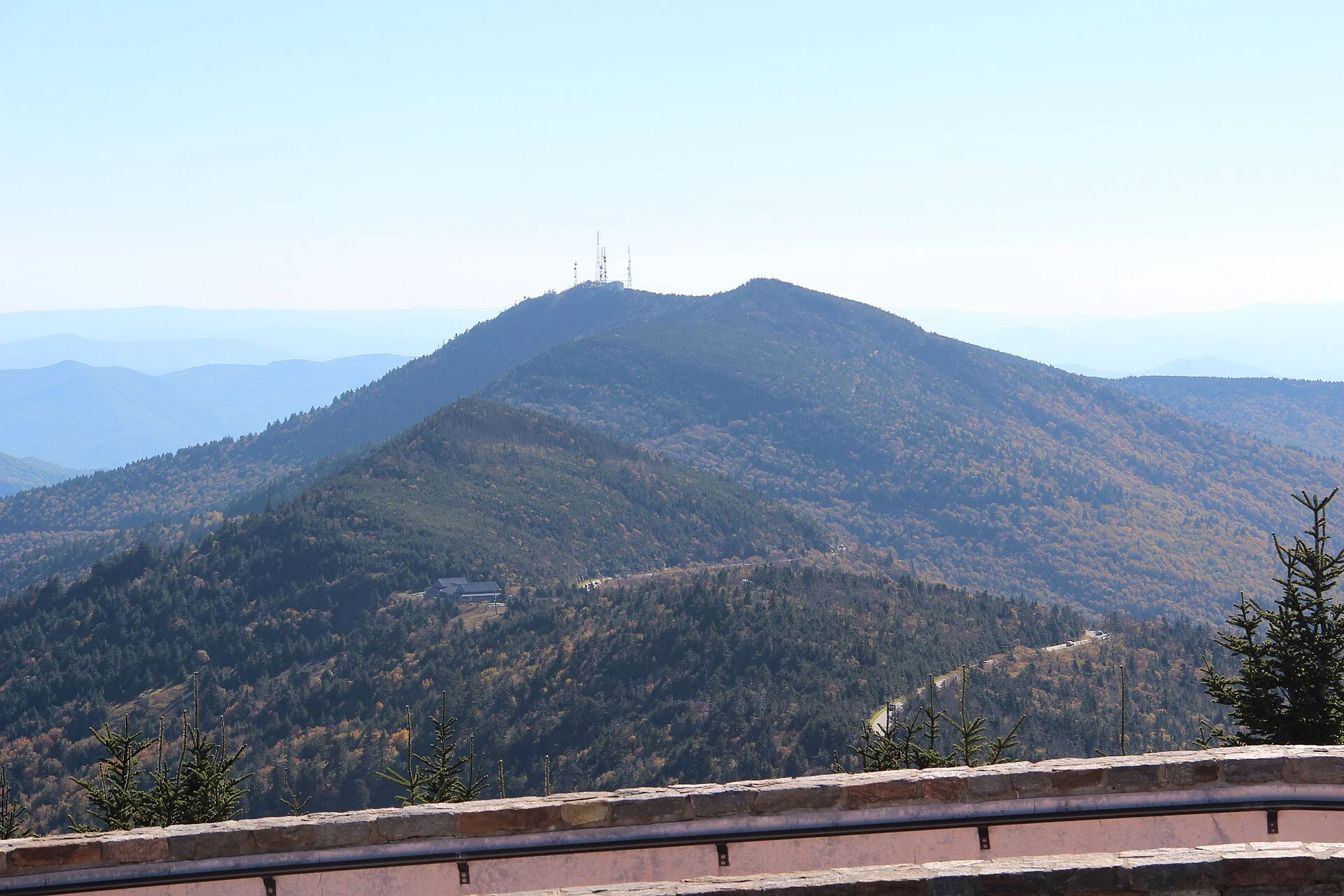
At 6,684 feet above sea level, Mount Mitchell State Park crowns the highest peak east of the Mississippi River — a windswept summit where spruce-fir forests cling to ancient Appalachian rock and panoramic views sweep across wave after wave of the Blue Ridge Mountains. Located in Yancey County along the Blue Ridge Parkway at milepost 355.4, this 4,800-acre preserve protects one of the most ecologically significant landscapes in the eastern United States. Standing atop Mount Mitchell feels like stepping into Canada — the cool, misty climate and boreal forest create a world utterly unlike the valleys below.
What Makes Mount Mitchell Extraordinary
Mount Mitchell isn’t just the highest point — it’s an ecological island. The summit’s spruce-fir forest is a relic of the last Ice Age, a narrow band of boreal ecosystem stranded on Appalachian peaks as glaciers retreated north. This fragile habitat shelters species found nowhere else at these latitudes: the endangered northern flying squirrel, the spruce-fir moss spider (one of the world’s rarest spiders), and dozens of plant species adapted to mountaintop conditions. The park occupies a critical piece of the Black Mountains, the highest mountain range in the eastern U.S., where six of the ten tallest eastern peaks cluster within just 15 miles.
Trails Worth Every Step
Mount Mitchell’s trail system ranges from wheelchair-accessible summit paths to grueling backcountry climbs. The network connects to Pisgah National Forest, creating nearly unlimited exploration possibilities.
Summit Trail & Observation Deck
The paved summit trail leads to a wheelchair-accessible observation deck offering 360-degree views on clear days extending over 70 miles. Nearby, the grave of Dr. Elisha Mitchell — the professor who proved this peak’s supremacy and died in the effort — rests beneath the Fraser firs. The short Balsam Nature Trail loops through the summit forest, interpreting the fragile spruce-fir ecosystem through informative signage.
Mount Mitchell Trail
The classic ascent: a 12-mile round trip climbing approximately 3,600 feet from the Black Mountain Campground to the summit. This strenuous hike follows the old toll road and Mount Mitchell Trail through diverse forest zones — hardwoods giving way to spruce and fir as altitude increases. Expect 6-8 hours for the full out-and-back, and be prepared for dramatic weather changes between base and summit.
Deep Gap & Mountains-to-Sea Trail
Experienced hikers can follow the Mountains-to-Sea Trail along the Black Mountain Crest, connecting multiple 6,000+ foot peaks including Mount Craig (6,647 ft), Big Tom (6,581 ft), and Balsam Cone (6,611 ft). This exposed ridgeline traverse offers some of the most spectacular high-elevation hiking in the eastern U.S., though weather can turn dangerous quickly. Backpacking permits through Pisgah National Forest extend these routes into multi-day adventures.
Camping at the Roof of the East
Mount Mitchell maintains 9 walk-in tent campsites at the park’s campground, each accommodating up to six people. Sites include tent pads, picnic tables, fire rings, and grills, with potable water and restrooms nearby. The season typically runs May 1 through October 31 — at nearly a mile high, winter conditions make camping impractical.
What to Know Before You Go
Weather Is No Joke
The summit averages 20°F cooler than Asheville valley temperatures. Fog, wind, and rain can appear with little warning, and the summit receives over 60 inches of precipitation annually. Snow is possible from October through April. Always bring layers, rain gear, and be prepared to turn back if conditions deteriorate. The park road closes during ice and snow events.
Best Times to Visit
Late September through mid-October brings spectacular fall color — the summit colors peak 2-3 weeks before the valleys below. June through August offers the most reliable weather, though afternoon thunderstorms are common. Rhododendron and flame azalea blooms peak in mid-June at the higher elevations, creating spectacular displays.
Park Facilities
The summit area includes a museum and exhibit hall interpreting the mountain’s natural and human history, a restaurant and concession stand (seasonal), a gift shop, and restroom facilities. The park entrance is free, though the Blue Ridge Parkway access road (NC-128) may close during adverse weather.
Local Insider Tips
- Sunrise visits from the observation deck are spectacular — arrive before dawn for the best light and fewest crowds
- The restaurant at the summit serves hearty Appalachian fare with arguably the best dining view in the eastern U.S.
- Mount Mitchell is part of the North Carolina Highpoint — state highpointers consider it one of the easier ones to reach, making it a popular bucket-list destination
- For photographers, cloud inversions in fall and spring create otherworldly scenes with peaks rising above a sea of fog
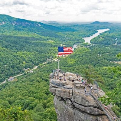
- Combine with a drive along the Blue Ridge Parkway — Craggy Gardens (milepost 364) offers stunning rhododendron displays in June just 10 miles south
Getting Here
From Asheville (35 miles): Take the Blue Ridge Parkway north to milepost 355.4, then turn north onto NC-128 for 2.4 miles to the park entrance. From Marion (30 miles): Take NC-80 north to the Blue Ridge Parkway, then south to milepost 355.4. The access road is winding but paved. No RV or trailer facilities are available — the summit parking area can fill by mid-morning on peak weekends, so arrive early.
Frequently Asked Questions
Are North Carolina state parks free?
Yes, all North Carolina state parks offer free admission. There are no entrance fees or vehicle permits required. Camping and some guided activities have fees.
What are the best state parks in the Blue Ridge Mountains?
Top mountain parks include Grandfather Mountain (Mile High Swinging Bridge), Hanging Rock (dramatic rock formations), Stone Mountain (largest exposed granite face in the state), and South Mountains (80-foot waterfall).
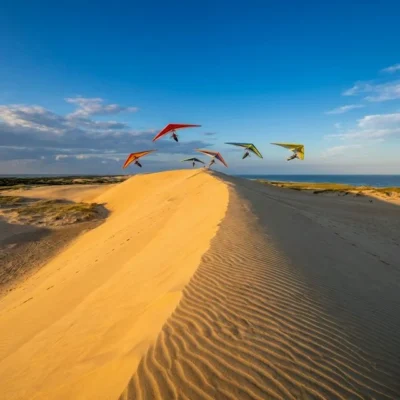
Can I climb the sand dunes at Jockey's Ridge?
Yes, Jockey’s Ridge State Park features the tallest active sand dune system on the Atlantic coast and visitors are free to climb and explore the dunes. It is also one of the top spots for hang gliding on the East Coast.
What is the best time to visit North Carolina state parks?
Spring (March-May) and fall (October-November) are ideal for hiking and outdoor activities. Summer offers the best beach conditions at coastal parks. Fall foliage in the mountains peaks in mid-to-late October.
Explore More North Carolina State Parks
Mount Mitchell State Park is one of many outstanding state parks in North Carolina. Discover more parks in our Best State Parks in North Carolina guide, or use our Park Finder to search by activity, location, or features.
Wildlife & Nature
Mount Mitchell SP — at 6,684 feet — is the highest peak east of the Mississippi River. The summit’s spruce-fir forest resembles Canadian boreal forest — an Ice Age relict ecosystem. Northern saw-whet owls, red crossbills, and black-capped chickadees inhabit the summit. Fraser fir trees are under severe threat from the balsam woolly adelgid.
Nearby Attractions
Burnsville — adjacent. Blue Ridge Parkway — access road at milepost 355. Asheville — 35 miles south. Craggy Gardens — 15 miles south on the Parkway.
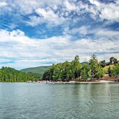
More parks nearby: Bullhead Mountain State Natural Area is a short drive away, while Lake James State Park lies within about an hour’s drive.

🐾 Dogs & Pets at Mount Mitchell State Park
- Pets allowed? statewide rule
- Pets are permitted in all North Carolina state parks as long as they are on an attended leash and under the constant control of the owner.
- Leash rule statewide rule
- Attended leash or other restraint no longer than 6 feet required at all times
- Beaches & swim areas statewide rule
- Pets are not permitted at swim areas or in bathhouses
- Cabins & lodging statewide rule
- Pets are strictly prohibited from entering any building, including cabins; no pet-friendly cabin program
- Statewide exceptions statewide rule
- Not all campgrounds allow pets (contact the park office first); pets must be confined to tent or vehicle during quiet hours (10 p.m.-7 a.m.); at Hammocks Beach visitors must arrange their own transportation for pets to Bear Island
Are dogs allowed at Mount Mitchell State Park?
Pets are permitted in all North Carolina state parks as long as they are on an attended leash and under the constant control of the owner. Individual parks can post stricter rules — check signage on arrival.
Rules verified July 2026 via ncparks.gov. More: North Carolina state parks guide · Dog rules in all 50 states compared
Park Location
Plan your gear for Mount Mitchell State Park
From our editorial guides, matched to this park’s activities:

Top Tours & Activities Near Asheville
 from $155
 from $68
 from $30