
Old Crossing Treaty Historic Wayside: 96
🏆🏆🏆🏆 Ojibwe-U.S. Treaty Site — Site of the 1863 Old Crossing Treaty between the U.S. and Red Lake & Pembina bands of Ojibwe
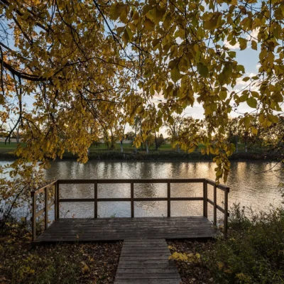
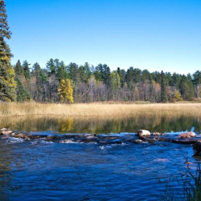
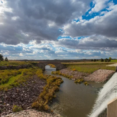
Old Crossing Treaty Historic Wayside marks the site where the U.S. government negotiated the Old Crossing Treaty of 1863 with the Red Lake and Pembina bands of Ojibwe. The treaty ceded over 11 million acres of land — roughly the northwestern quarter of Minnesota — in exchange for annuity payments that were largely never delivered. The 96-acre site on the Red Lake River includes the original treaty ground, a granite monument, and interpretive panels. The crossing was a major fording point on the ox cart trails connecting St. Paul to Winnipeg.
Visitor Information
| Detail | Information |
|---|---|
| Location | Red Lake River, Polk County, MN |
| Size | 96 acres |
| Entry Fee | Free |
| Treaty | 1863 — ceded 11 million acres |
Frequently Asked Questions
What happened to the Ojibwe after the treaty?
The annuity payments promised were largely never delivered or were given to traders. The Red Lake Band retained their reservation — one of the few in Minnesota never dissolved. Today, the Red Lake Nation has the largest reservation in Minnesota.
Why is the Red River Valley so flat?
The Red River Valley is the bed of glacial Lake Agassiz — a massive lake that covered 110,000 square miles during the last Ice Age. When the lake drained, it left behind a perfectly flat plain of rich lake-bottom sediment. The valley is so flat that the Red River flows north at barely 1 foot per mile — causing notorious spring flooding.
Keep exploring: The closest neighbors are Red River State Recreation Area (within about an hour’s drive) and Buffalo River State Park (elsewhere in the state).
🪶 Visit Old Crossing Treaty
1863 treaty site — where 11 million acres of Ojibwe homeland were ceded.
About Old Crossing Treaty
Old Crossing Treaty Historic Wayside in Polk County marks where the 1863 Old Crossing Treaty was signed between the United States and the Red Lake and Pembina bands of Ojibwe — ceding much of northwestern Minnesota to the government. The crossing of the Red Lake River here was a strategic point on the Red River oxcart trails that connected the fur trade posts.
Things to Do
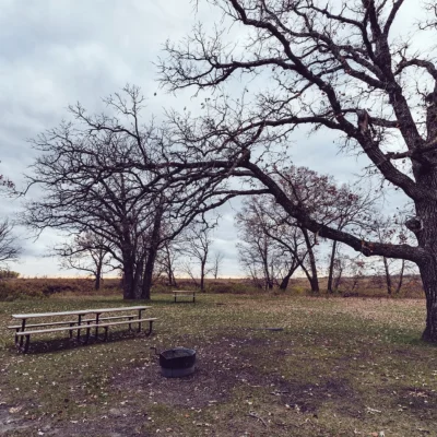
Visiting the treaty site monument, reading interpretive panels on the 1863 treaty and its consequences, picnicking, and reflecting on the fur trade and Native American history of northwestern Minnesota.
Insider Tips
Treaty history: Old Crossing marks where the 1863 Treaty of Old Crossing was signed — the Ojibwe ceded the Red River Valley to the US government. Pro tip: The Red River Valley that was ceded became some of the most productive farmland in the world — the ancient Lake Agassiz lakebed is perfectly flat and incredibly fertile. Context: Like most treaties, the terms heavily favored the US government — understanding this history is essential.
Best Time to Visit
Year-round: Historic memorial. Summer: Greenest season in the Red River Valley. Fall: Harvest time — the valley’s agricultural scale is impressive. Winter: Quiet and reflective.
Wildlife & Nature
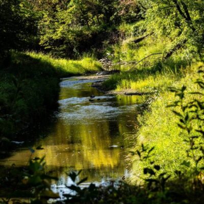
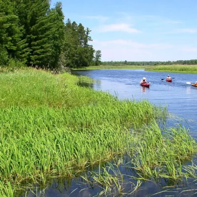
Old Crossing — marks the site of the 1863 Old Crossing Treaty between the US and Red Lake/Pembina Chippewa. The park’s Red Lake River bottomland supports bald eagles, white-tailed deer, and beavers. Great blue herons fish the river. Wood ducks nest.
Nearby Attractions
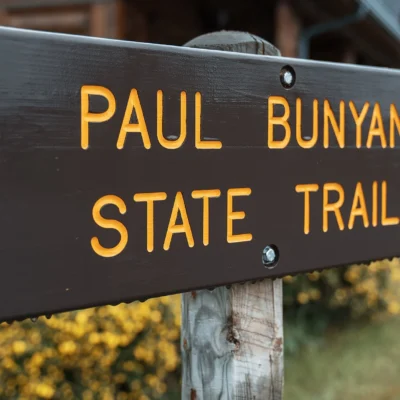
Red Lake Falls — adjacent. Crookston — 20 miles west. Thief River Falls — 30 miles north. Red Lake River — canoe route.

Park Location
Top Tours & Activities in Minnesota
 from $79
 from $110
 from $195