
🌤 Weather at Stanley Works Wildlife Management Area by season
| Spring | Summer | Fall | Winter |
|---|---|---|---|
| 23–72 °F | 53–85 °F | 29–76 °F | 14–40 °F |
Each range runs from the coldest monthly average low to the warmest monthly average high in that season (1991-2020 climate normals), measured at Falls Village, 13 mi away, elevation 550 ft. Conditions at the park can differ from the station, especially where elevation differs — check a forecast before you go.

Stanley Works Wildlife Management Area is a 1,464-acre permit-required hunting area on federal open space along the Housatonic River in Kent and Sharon, Litchfield County, listed by Connecticut DEEP.
Visitor Information
| Detail | Information |
|---|---|
| Location | River Road, Kent, CT 06757 (DEEP hunting area map, U.S. Census) |
| Size | 1,464 acres (DEEP hunting area map, as of October 2026) |
| Type | Cooperative hunting area on federal land (DEEP) |
| Entry Fee | No entrance fee is listed by DEEP (as of October 2026) |
| Hunting | Permit-required hunting area, small game and waterfowl only (DEEP, as of October 2026) |
Frequently Asked Questions
Is hunting allowed at Stanley Works WMA?
Yes. DEEP’s hunting-area data (as of October 2026) list 1,464 acres of Stanley Works WMA as a permit-required hunting area. It is open for small game and waterfowl, but closed to turkey and deer hunting. Daily permits are required from the third Saturday in October until the last day of February (CT Outdoor Licenses). DEEP notes that the lands are not open outside this period without permission from the landowners. Check the DEEP hunting area map and the current Connecticut Hunting and Trapping Guide for season dates before you go.
Where do I park for Stanley Works WMA?
Parking areas are off River Road in Sharon and River Road in Kent. (DEEP hunting area map, as of October 2026)
Who owns Stanley Works WMA?
DEEP lists the land as federal open space and the area as a cooperative wildlife management area with permit-required hunting. The Appalachian Trail crosses it. For rules beyond hunting, contact DEEP’s Wildlife Division (as of October 2026).
About Stanley Works WMA
DEEP’s mapped property boundary lies in Kent and Sharon, across the town line between Kent and Sharon.
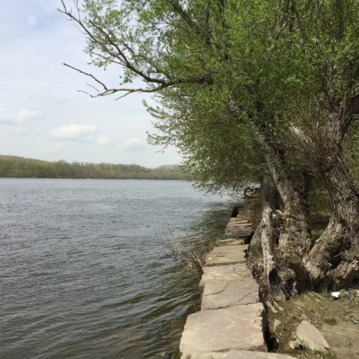
DEEP’s hydrography data show Choggam Brook, Fuller Mountain Brook, Housatonic River, North Kent Brook, and Stewart Hollow Brook on or along the property. The 2021 National Land Cover Database (NLCD) maps the area as 93 percent forest and 2 percent pasture and cropland.
Things to Do
Hunters can use the area for small game and waterfowl hunting under DEEP’s rules for this area. DEEP trail data show about 5.3 miles of the Appalachian Trail inside the area, with spurs to the Stony Brook campsites and the Stewart Hollow Brook lean-to.
Nearby Attractions
Housatonic River Wildlife Management Area, a 585-acre wildlife management area, borders the area to the southwest. Kent Falls State Park, a 227-acre state park, is less than a mile east. Wyantenock State Forest, a 4,062-acre state forest, is less than a mile east. Macedonia Brook State Park, a 1,829-acre state park, is less than a mile west. Distances are straight-line between the DEEP property boundaries; acreages are DEEP’s mapped figures.

Park Map
Plan your gear for Stanley Works Wildlife Management Area
From our editorial guides, matched to this park’s activities: