Willamette Stone State Heritage Site
The Initial Point of the Willamette Meridian: every land survey and property description in Oregon and Washington is referenced to
The Initial Point of the Willamette Meridian: every land survey and property description in Oregon and Washington is referenced to
🏆 Forested stretch of OR 82 in the lower Wallowa River canyon between Minam and the town of Wallowa, on
🏆 Mountain forest corridor in the Blue Mountains of eastern Oregon — ponderosa pine forests at 4,000+ feet elevation. Visitor
🛶 Umpqua State Scenic Corridor — A small boat ramp and picnic stop on the Umpqua River in Douglas County,
🏖️ Tseriadun — A day-use beach site at Port Orford in Curry County with a miles-long beach, agate collecting and

🏆 Wide sandy beach near Warrenton — views of the Columbia River Bar, “Graveyard of the Pacific,” where over 2,000

🏆 Secluded beach with exposed rock formations and tide pools — one of the quieter, lesser-known beaches on the central
🌲 Small Oregon state scenic corridor in the Columbia River Gorge, just west of Cascade Locks. Visitor Information Detail Information
Paradise Point State Recreation Site is a day-use coastal viewpoint and beach access just north of Port Orford, Oregon, known for beachcombing for agates and glass floats and for views to Cape Blanco.

🏆 Rocky headland on the southern Oregon coast — tide pools, sea stacks, and excellent whale watching. Sea otters were
🏆 Rest area on the Snake River at the Oregon-Idaho border — Ontario is Oregon’s eastern gateway, where Pacific and

🏆 Beautiful park where Beaver Creek meets the Pacific Ocean — sheltered beach, estuary habitat, and the Beaver Creek marsh
🌲 State-Owned City Park — About 128 acres of forest on the Willamette River in West Linn, owned by Oregon

🏆 Multi-use trail along the Historic Columbia River Highway — America’s first planned scenic highway (1913–1922), an engineering masterpiece by

🏆 Forest corridor along OR 18 in the Coast Range, with an Oregon State Parks rest stop. Named for Henry

🏖️ Governor Patterson — Flat sandy beach a short hike from the mouth of Alsea Bay on the central Oregon
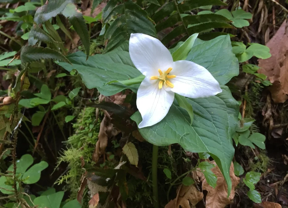
🏆 Forest above Latourell Creek in the Columbia River Gorge that holds Upper Latourell Falls and part of the Latourell

🏆 Fall Creek State Recreation Site — A scenic day-use area along Fall Creek Reservoir in the Oregon Cascade foothills,

🏆 Home of the D River — the world’s shortest river at only 120 feet! It flows from Devils Lake

🏆 Day-use park on the upper Rogue River off the Crater Lake Highway — boat ramp, riverside picnic lawns and
🏆 Dramatic 700-foot cape on the southern Oregon coast — one of the most spectacular ocean viewpoints in the Pacific

🌲 Bradley State Scenic Viewpoint — A rest stop on Highway 30 with a Douglas fir forest overlooking the Columbia
🌲 Booth State Scenic Corridor — A roadside stop under old-growth Ponderosa Pines on Highway 140 between Klamath Falls and
🏆 Small day-use park on Bolon Island in the Umpqua River at Reedsport, with a trail half way around the

🏔️ Top of Hatcher Pass — A small alpine cirque lake beside the 3,886-foot summit of Hatcher Pass, reachable by
A Half-Mile Sand Spit at the Tip of Fox Island in Resurrection Bay Sandspit Point State Marine Park lies at
Mosquito Lake State Recreation Site is a small campground on Mosquito Lake, off Mile 27.2 of the Haines Highway northwest

🏆 Alaska Wilderness — Coastal recreation area south of Seward — beachfront access to Resurrection Bay with sea otters, harbor
🏆 Alaska Wilderness — Spectacular waterfall on the Edgerton Highway — stunning cascading falls dropping through a narrow canyon of

🏆 Alaska Wilderness — Remote 28-square-mile lake — largest lake in the Copper River Basin, excellent lake trout and burbot
🏆 Alaska Wilderness — Coastal recreation site near Sitka — scenic oceanfront picnicking and tidepooling on Baranof Island with views

🏆 Alaska Wilderness — Glacier-carved finger lake in the Matanuska-Susitna Valley — popular swimming and canoeing destination surrounded by boreal

🏆 Alaska Wilderness — Campground at the confluence of the Delta and Tanana Rivers — gateway to the Alaska Range
🏆 Alaska Wilderness — Kenai Peninsula beach fishing — one of Alaska’s most popular shore-based king salmon fisheries where the
Where Passage Canal Opens to Port Wells, Eight Miles from Whittier Decision Point State Marine Park covers 460 acres at

🏆 Alaska Wilderness — Big Lake south shore — boat launch and camping on Big Lake, the recreational heart of

🏆 Alaska Wilderness — Big Lake north shore — popular Matanuska-Susitna Valley lake recreation area with 3,000-acre Big Lake, one
🏆 River Access — Day-use recreation site on the Chena River — convenient access for fishing and paddling near Fairbanks

Chena River State Recreation Area covers 397 square miles of forest, rivers and alpine tundra along Chena Hot Springs Road

🏆 Drive-Up Glacier — One of Alaska’s most accessible glaciers — you can walk right up to the face of

🏆 Juneau Wilderness — 2,850-acre coastal park north of Juneau — meadows, old-growth forest, and whale-watching from shore along Lynn

🏆 Alaska Transfer Site — The exact spot where Russia transferred Alaska to the United States on October 18, 1867
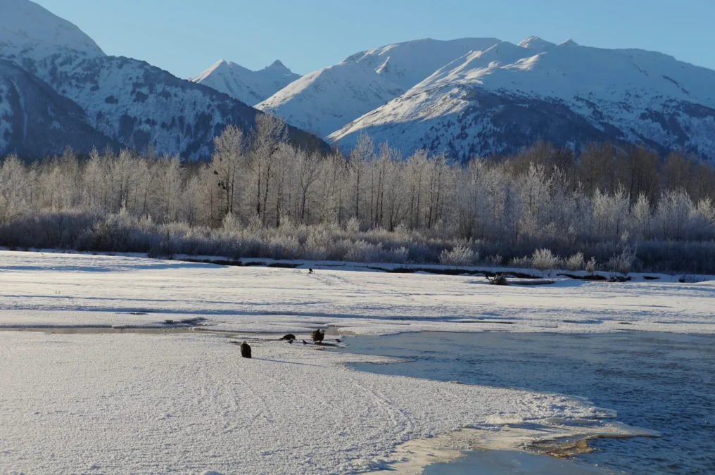
🏆 Eagle Preserve — 48,000-acre preserve protecting one of the world’s largest concentrations of bald eagles, which gather here each

🏆 At 195 miles, the Cowboy Trail is the longest rail-trail in Nebraska and one of the longest in the
🏆 700-acre reservoir in Pierce County — built on Willow Creek as a flood-control project, now a popular fishing and
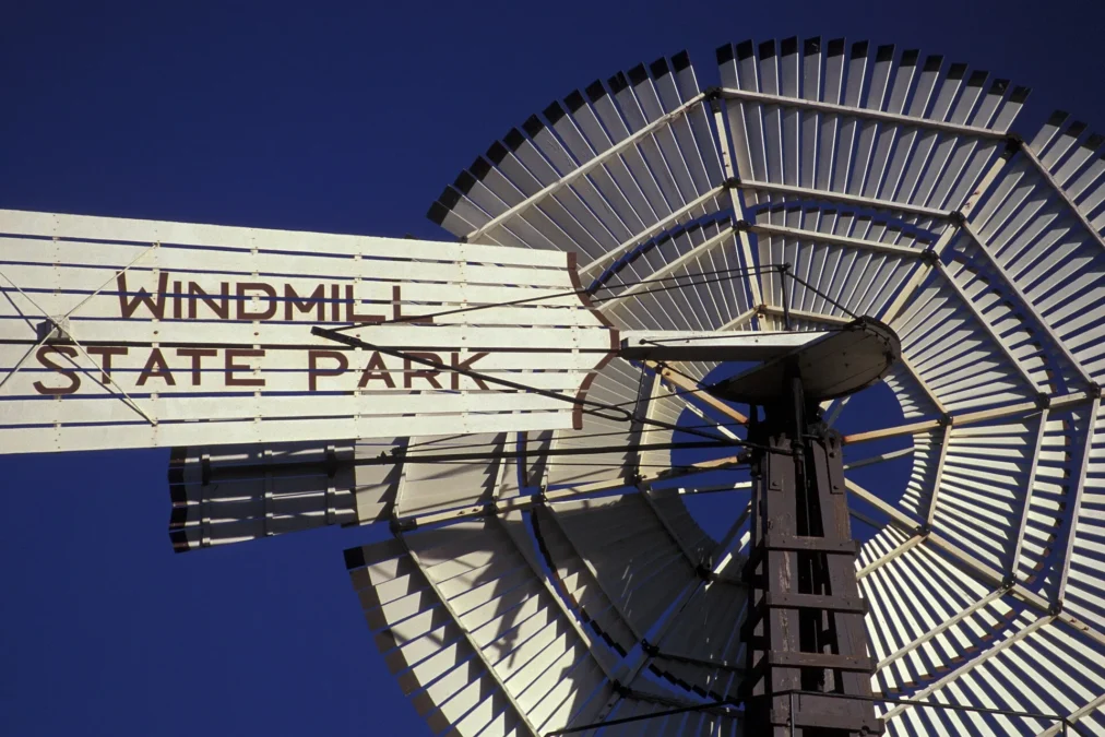
🏆 Named for the iconic Great Plains windmill — the wind-powered water pump that made settlement of the treeless Plains
🏆 Named after a local creek — small recreation area near Norfolk, birthplace of Johnny Carson (the legendary Tonight Show
🏆 Small lake famous for its local legend — the “Walgren Lake Monster” (a Nessie-like creature reported since the 1920s!).
🏆 315-acre lake named for the wagon trains that crossed this prairie on the Oregon Trail. Popular bass fishing destination
🏆 Small lake in the far southeastern corner of Nebraska — Richardson County borders both Kansas and Missouri. Visitor Information